Valdivia Province facts for kids
Quick facts for kids
Valdivia Province
Provincia de Valdivia
|
|||||
|---|---|---|---|---|---|
|
|||||
| Country | |||||
| Region | Los Ríos | ||||
| Capital | Valdivia | ||||
| Comunas | See list | ||||
| Government | |||||
| • Type | Provincial | ||||
| Area | |||||
| • Total | 10,197.2 km2 (3,937.2 sq mi) | ||||
| Population
(2002 Census)
|
|||||
| • Total | 259,243 | ||||
| • Density | 25.42296/km2 (65.8452/sq mi) | ||||
| Time zone | UTC-4 (CLT) | ||||
| • Summer (DST) | UTC-3 (CLST) | ||||
| Website | Government of Valdivia | ||||
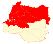
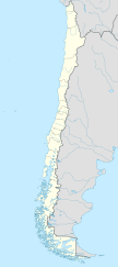
The Valdivia Province (called Provincia de Valdivia in Spanish) is one of two provinces in the Los Ríos area of Chile. The main city and capital of this province, and also of the whole region, is Valdivia.
Contents
Exploring Valdivia Province Geography
The Valdivia province is located in the northern part of the Los Ríos region. It covers an area of about 10,197.2 sq mi (26,411 km2). The capital city, Valdivia, is found in the western part of the province.
Valdivia province shares its borders with several other areas. To the north, it meets the Cautín province in the La Araucanía region. To the east, it borders Argentina. South of Valdivia province is the El Ranco province. To the west, it touches the vast Pacific Ocean.
The most important river in the province is the Valdivia river.
Valdivia's Climate and Weather
The climate in Valdivia province, especially in the city of Valdivia, is known as an oceanic climate. This type of climate is also called a Marine West Coast Climate, or Cfb in the Köppen climate classification system.
The average temperature for the entire year in Valdivia is about 12.3 °C (54.1 °F). January is usually the warmest month, with an average temperature of 17 °C (63 °F). July is typically the coolest month, with an average temperature of 8 °C (46 °F).
Valdivia receives a lot of rain throughout the year. The average amount of precipitation is about 2,489 mm (98.0 in). June is the wettest month, with an average of 414 mm (16.3 in) of rain. January is the driest month, receiving only about 65 mm (2.6 in) of rain on average.
Population in Valdivia Province
According to the last national census in As of 2002[update], there were 259,243 people living in Valdivia province. This means the population density was about 25.4 people per square kilometer. Most of the people, 192,066 (which is 74% of the total), lived in urban areas.
The biggest city in the province, based on the 2002 census, is its capital, Valdivia. It had 127,750 residents at that time.
How Valdivia Province is Governed
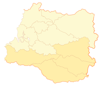
Valdivia is a province, which means it's a second-level administrative division in Chile. It is made up of 8 smaller areas called comunas. The city of Valdivia is the capital of the province. A governor is in charge of running the province.
| Code | Comuna | Capital | Area (km²) |
Population (2002) |
Density |
|---|---|---|---|---|---|
| 14101 | Valdivia | Valdivia | 1,015.6 | 140,559 | 138.4 |
| 14102 | Corral | Corral | 766.7 | 5,463 | 7.1 |
| 14103 | Lanco | Lanco | 532.4 | 15,107 | 28.4 |
| 14104 | Los Lagos | Los Lagos | 1,791.2 | 20,168 | 11.3 |
| 14105 | Máfil | Máfil | 582.7 | 7,213 | 12.4 |
| 14106 | Mariquina | Mariquina | 1,320.5 | 18,223 | 13.8 |
| 14107 | Paillaco | Paillaco | 896.0 | 19,237 | 21.5 |
| 14108 | Panguipulli | Panguipulli | 3,292.1 | 33,273 | 10.1 |
| Total of Valdivia province | 10,197.2 | 259,243 | 25.4 | ||
Related pages
See also
 In Spanish: Provincia de Valdivia para niños
 | James Van Der Zee |
 | Alma Thomas |
 | Ellis Wilson |
 | Margaret Taylor-Burroughs |


