Máfil facts for kids
Quick facts for kids
Máfil
|
||||||
|---|---|---|---|---|---|---|
|
||||||
| Country | Chile | |||||
| Region | Los Rios | |||||
| Province | Valdivia | |||||
| Founded | 17 July 1964 | |||||
| Government | ||||||
| • Type | Municipality | |||||
| Area | ||||||
| • Total | 582.7 km2 (225.0 sq mi) | |||||
| Elevation | 14 m (46 ft) | |||||
| Population
(2012 Census)
|
||||||
| • Total | 7,212 | |||||
| • Density | 12.3769/km2 (32.056/sq mi) | |||||
| • Urban | 4,250 | |||||
| • Rural | 3,417 | |||||
| Sex | ||||||
| • Men | 3,773 | |||||
| • Women | 3,440 | |||||
| Time zone | UTC-4 (CLT) | |||||
| • Summer (DST) | UTC-3 (CLST) | |||||
| Area code(s) | 56 + 63 | |||||
| Website | Municipality of Máfil | |||||
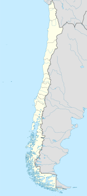
Máfil is a city and a "commune" (like a local district) in southern Chile. Its name comes from the Mapudungun language, spoken by the Mapuche people, and means "embraced between rivers". It is located in the Valdivia Province of the Los Ríos Region, about 30 kilometers northeast of the city of Valdivia.
Máfil is known for its dairy industry, which produces milk products. The town of Máfil itself is a local hub. It offers services like basic education and a community health center. Compared to other areas in the Los Ríos Region, Máfil is in a central spot. It has good roads that connect it to nearby towns.
The climate in Máfil is temperate oceanic. This means it has mild temperatures and gets rain throughout the year. However, it has at least four drier months. In winter, it receives about 803 mm of rain, and in summer, about 189 mm. The natural plant life in Máfil is the Valdivian temperate forests. These are lush, green forests with many types of trees.
Máfil has important natural resources. These include forests and their timber, which is used for wood. There is also gold found at the Madre de Dios Mine. Coal can be found in areas like Pupunahue and Millahuillín. The soil in the commune is volcanic, which is very fertile.
History of Máfil
The area now known as Máfil was once called Pidey. It was mainly home to the Huilliche people, who are a group of Mapuche people. In the late 1800s, German farmers came and settled in Máfil.
The name "Máfil" became official around 1910. This was when a land survey map was published showing the new name.
In 1953, a large plant was planned in Pupunahue. This plant was meant to turn coal into gas using German technology. The idea was to build an even bigger plant later in the Magallanes Region, where there was more coal. However, the building of this gasification plant stopped during the government of Jorge Alessandri. Its parts and materials were then sold, left behind, or even stolen.
The commune of Máfil was officially created in 1964. This happened during the time Jorge Alessandri was president.
Máfil's Population and People
In 2002, a census was taken by the National Statistics Institute. It showed that Máfil covers an area of 582.7 square kilometers. At that time, it had 7,213 people living there. This included 3,773 men and 3,440 women.
More than half of the people, about 3,796 (52.6%), lived in urban areas (towns). The rest, 3,417 people (47.4%), lived in rural areas (the countryside). Between 1992 and 2002, the population of Máfil actually went down by 7%. By 2017, the town of Máfil itself had 5,237 residents.
How Máfil is Governed
As a commune, Máfil is a local administrative area in Chile. It is managed by a municipal council. The council is led by an alcalde, which is like a mayor. The alcalde is chosen directly by the people every four years. The current alcalde is Claudio Sepúlveda Miranda.
Máfil is also part of larger electoral areas. For example, it is part of the 24th electoral district for the Chamber of Deputies. This is where representatives are elected to help make laws for the country. It is also part of the 12th senatorial constituency for the Senate, which is another part of the national government.
 |
Mariquina | Lanco |  |
|
| Panguipulli | ||||
| Valdivia | Los Lagos |
See also
 In Spanish: Máfil para niños
 | Janet Taylor Pickett |
 | Synthia Saint James |
 | Howardena Pindell |
 | Faith Ringgold |


