Panguipulli facts for kids
Quick facts for kids
Panguipulli
|
||||||
|---|---|---|---|---|---|---|
|
||||||
| Nickname(s):
City of roses, Comune of the seven lakes
|
||||||
| Motto(s):
Land of Lions
|
||||||
| Country | Chile | |||||
| Region | Los Ríos | |||||
| Province | Valdivia | |||||
| Founded as | Villa de Panguipulli | |||||
| Founded | 1946 | |||||
| Government | ||||||
| • Type | Municipality | |||||
| Area | ||||||
| • Total | 3,292.1 km2 (1,271.1 sq mi) | |||||
| Elevation | 130 m (430 ft) | |||||
| Population
(2012 Census)
|
||||||
| • Total | 32,525 | |||||
| • Density | 9.87971/km2 (25.5883/sq mi) | |||||
| • Urban | 15,888 | |||||
| • Rural | 17,385 | |||||
| Sex | ||||||
| • Men | 17,059 | |||||
| • Women | 16,214 | |||||
| Time zone | UTC−4 (CLT) | |||||
| • Summer (DST) | UTC−3 (CLST) | |||||
| Area code(s) | 56 + 63 | |||||
| Climate | Cfb | |||||
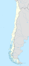
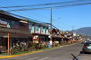
Panguipulli (/ˌpæŋɡiˈpuːji/ PANG-gee-POO-yee) is a city and commune in southern Chile. Its name comes from the Mapudungun language, meaning "hill of the puma." The city is located on the western edge of Panguipulli Lake. It sits on a moraine in the Chilean Central Valley. Most of the commune is made up of Andean mountains and valleys.
Panguipulli has many hydropower resources. It also has large areas of protected land. These include national parks and nature reserves.
Contents
History of Panguipulli
The first people to live in the Panguipulli area were the Mapuche people. They lived along the shores of the lakes and rivers. Panguipulli was first mentioned in records in 1776.
In 1885, Guillermo Angermaier was the first non-indigenous person to settle here. He made his home on the western shores of Panguipulli Lake. The city of Panguipulli was officially founded much later, in 1946.
The Capuchin Mission
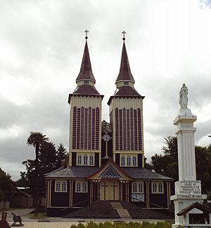
In 1903, the Capuchin monks started a mission in Panguipulli. These monks built the first schools in the area. In 1947, the Capuchins also built Panguipulli's famous wooden church. This church has twin towers and is now a well-known local landmark.
Panguipulli's Population
According to the 2002 census, Panguipulli covers an area of 3,292.1 square kilometers. It had 33,273 people living there. About 15,888 people lived in city areas. The remaining 17,385 people lived in country areas. Between 1992 and 2002, the population grew by 10.3%.
Explore Panguipulli: Tourism
Many visitors come to Panguipulli to enjoy nature. The local government promotes the nearby Seven Lakes for tourism. There are many fun things to do and see.
Popular Attractions
- Hot Springs: You can visit the hot springs at Liquiñe.
- Volcano Adventures: Explore the Mocho-Choshuenco volcano.
- Nature Reserve: Visit the Huilo-Huilo Biological Reserve. You can even go skiing there all year round!
- Outdoor Activities: Rafting and wild boar hunting are also popular activities in the region.
Connecting to Argentina
Panguipulli is connected to San Martín de los Andes in Argentina. This connection is made through the Hua-Hum international pass. It is one of the few passes between Chile and Argentina that stays open all year. The path follows a natural dip in the land. This dip is now filled by Pirihueico Lake. To cross this lake, a ferry operates twice a day from Puerto Fuy. Puerto Fuy is about a half-hour drive east of Panguipulli.
Panguipulli's Geography
The area around Panguipulli has an Alpine landscape. This means it has tall mountains and deep valleys. These features were shaped by ancient glaciers and recent volcanoes.
There are two main types of land here:
- Precordillera: This area covers most of western Panguipulli. It has forest-covered hills. These hills are cut by large valleys. These valleys are filled with glacial lakes like Calafquén, Panguipulli, and Riñihue.
- Andes: This zone includes the higher mountain ranges.
The lakes of Calafquén and Panguipulli were formed by natural dams of rock and dirt left by glaciers. They both flow westward into Riñihue Lake.
Local Government
Panguipulli is a commune. This means it is a local area with its own government. It is run by a municipal council. The head of the council is called an alcalde. The alcalde is chosen by the people in an election every four years.
 In Spanish: Panguipulli para niños


