Riñihue Lake facts for kids
Quick facts for kids Riñihue Lake |
|
|---|---|

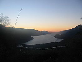
Sunset, view from Mocho-Choshuenco
|
|
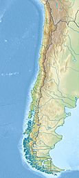
| Location | Los Lagos Commune, Valdivia Province, Los Ríos Region, Chile |
| Coordinates | 39°50′36″S 72°17′39″W / 39.84333°S 72.29417°W |
| Primary inflows | Enco River |
| Primary outflows | San Pedro River |
| Basin countries | Chile/Argentina |
| Max. length | ca. 28.6 km (17.8 mi) |
| Max. width | ca. 5.2 km (3.2 mi) |
| Surface area | 77.5 km2 (29.9 sq mi) |
| Average depth | 162 m (531 ft) |
| Max. depth | 323 m (1,060 ft) |
| Water volume | 12.56 km3 (3.01 cu mi) |
| Shore length1 | ca. 72.8 km (45.2 mi) |
| Surface elevation | ca. 108 m (354 ft) |
| Settlements | Riñihue |
| 1 Shore length is not a well-defined measure. | |
The Riñihue Lake (called Lago Riñihue in Spanish) is a beautiful lake in southern Chile. It was formed by glaciers long ago. The lake is surrounded by many mountains. It gets most of its water from Panguipulli Lake through the Enco River. Riñihue Lake is the last lake in a group known as the Seven Lakes. On its west side, Tralcán Mount divides it into two parts. The Mocho-Choshuenco volcano is on its east side. To the south, the Cerros de Quimán mountains border the lake.
The name Riñihue comes from the Mapuche language. Rëngi means "cane" and hue means "place". So, it means "place of canes". In the 1500s, people called it Comohue, which meant "place with water".
What Was the Riñihuazo?
Riñihue Lake became very famous because of an event called the "Riñihuazo". This event almost caused a huge disaster for many towns and cities in southern Chile.
During the Great Chilean earthquake in 1960, a large landslide happened near Tralcan Mount. This landslide blocked the natural flow of water out of Riñihue Lake. The lake's water level started to rise very quickly, going up more than 20 meters (about 65 feet).
People worried that the natural dam created by the landslide would break. If it broke, a massive flood would rush downstream. This flood could destroy everything in its path, including the big city of Valdivia. There were plans to evacuate Valdivia, and many people left the city to be safe.
To prevent this disaster, a large team of workers came together. They worked hard to dig a new channel through the landslide. This channel allowed the trapped water to drain out slowly and safely. Thanks to their efforts, the lake's water level slowly returned to normal. This saved the towns and cities downstream from a terrible flood. There is also evidence that a similar landslide and earthquake happened in 1575.
See also
 In Spanish: Lago Riñihue para niños
 | Audre Lorde |
 | John Berry Meachum |
 | Ferdinand Lee Barnett |


