Parangana Power Station facts for kids
Quick facts for kids Parangana Dam |
|
|---|---|
|
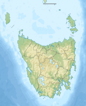
Location of the Parangana Dam in Tasmania
|
|
| Country | Australia |
| Location | North-western Tasmania |
| Coordinates | 41°37′48″S 146°13′12″E / 41.63000°S 146.22000°E |
| Purpose | Power |
| Status | Operational |
| Opening date | 1968 |
| Owner(s) | Hydro Tasmania |
| Dam and spillways | |
| Type of dam | Embankment dam |
| Impounds | Mersey River |
| Height | 53 metres (174 ft) |
| Length | 189 metres (620 ft) |
| Dam volume | 382 thousand cubic metres (13.5×10⁶ cu ft) |
| Spillways | 1 |
| Spillway type | Uncontrolled |
| Spillway capacity | 2,093 cubic metres per second (73,900 cu ft/s) |
| Reservoir | |
| Creates | Lake Parangana |
| Total capacity | 14,820 megalitres (523×106 cu ft) |
| Catchment area | 715 square kilometres (276 sq mi) |
| Surface area | 11.4 hectares (28 acres) |
| Power station | |
| Name | Parangana Power Station |
| Operator(s) | Hydro Tasmania |
| Commission date | 2002 |
| Type | M |
| Hydraulic head | 35 metres (115 ft) |
| Turbines | 1 x 0.75 MW (1,010 hp) Tyco Tamar Francis turbine |
| Installed capacity | 0.75 megawatts (1,010 hp) |
| Capacity factor | 0.81 |
The Parangana Power Station is a special kind of power plant in north-western Tasmania, Australia. It's called a mini-hydro power station. This means it uses the power of water to make electricity, but on a smaller scale.
It sits right below the Parangana Dam, which is a big wall built across the Mersey River. This dam creates a large lake called Lake Parangana.
Parangana Dam and Power Station
The Parangana Power Station is unique because it's the only mini-hydro station in the Mersey-Forth power system. This system includes seven other, larger power stations. Together, they help provide electricity for Tasmania.
How Does it Work?
The power station started working in 2002. It has one special machine called a Francis turbine. This turbine is like a giant water wheel. As water from Lake Parangana flows through it, the turbine spins. This spinning motion then creates electricity.
The Parangana Power Station can produce about 0.85 megawatts of electricity. This is enough to power many homes!
Water's Journey
Most of the water from Lake Parangana travels a long way, about 8 kilometers (5 miles). It goes through tunnels to another power station called the Lemonthyme Power Station. After making electricity there, the water flows into the Forth River.
However, some water is allowed to continue down the Mersey River. This happens after it has passed through the Parangana mini-hydro station. This is important for the environment, making sure the river stays healthy.
The Parangana Dam
The Parangana Dam itself is a large structure. It is 53 meters (174 feet) tall and 189 meters (620 feet) long. It's made of rock and has a clay core inside. The dam holds back a huge amount of water, creating Lake Parangana. This lake can hold over 14,820 million liters of water!
The dam was completed in 1968. It plays a key role in managing the water flow in the Mersey River. Both the dam and the power station are owned by Hydro Tasmania, which manages most of Tasmania's hydroelectric power.
 | George Robert Carruthers |
 | Patricia Bath |
 | Jan Ernst Matzeliger |
 | Alexander Miles |


