Parker, South Carolina facts for kids
Quick facts for kids
Parker, South Carolina
|
|
|---|---|
| Country | United States |
| State | South Carolina |
| County | Greenville |
| Area | |
| • Total | 6.90 sq mi (17.88 km2) |
| • Land | 6.86 sq mi (17.76 km2) |
| • Water | 0.04 sq mi (0.12 km2) |
| Elevation | 1,020 ft (310 m) |
| Population
(2020)
|
|
| • Total | 13,407 |
| • Density | 1,954.94/sq mi (754.77/km2) |
| Time zone | UTC−5 (Eastern (EST)) |
| • Summer (DST) | UTC−4 (EDT) |
| FIPS code | 45-54535 |
| GNIS feature ID | 1867528 |
Parker is a special kind of community in Greenville County, South Carolina, United States. It's called a census-designated place (CDP). This means it's an area that looks like a town but doesn't have its own local government.
In 2010, about 11,431 people lived in Parker. By 2020, this number grew to 13,407 people. Parker is part of a larger area called the Greenville-Mauldin-Easley metropolitan area. This is a big region that includes several cities and towns.
Contents
Where is Parker Located?
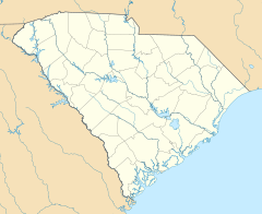
Parker is in the western part of Greenville County. It's located at coordinates 34.853637 degrees North and -82.439776 degrees West.
Parker shares its borders with several other places. To the east, it touches the city of Greenville. To the northeast, you'll find City View and Sans Souci. Berea is to the north. To the west, Parker borders Pickens County. The Saluda River forms this western border. To the south, Parker is next to Welcome.
Important Roads in Parker
Several important roads run through or near Parker.
- U.S. Route 123 (also known as New Easley Highway or Easley Bridge Road) forms the southern border of Parker. This road goes east about 4 miles (6.4 km) to the center of Greenville. If you go west on US 123, you'll reach Easley in about 8 miles (12.9 km).
- South Carolina Highway 124 (Old Easley Highway) goes right through the middle of Parker. It also connects to Greenville in the east and US 123 in Pickens County to the west.
- U.S. Route 25 (White Horse Road) is on the eastern side of Parker. This road goes north about 10 miles (16 km) to Travelers Rest. If you head south on US 25, you'll reach Interstate 185 in about 3.5 miles (5.6 km).
How Big is Parker?
The total area of Parker is about 6.9 square miles (17.8 square kilometers). Most of this area is land. Only a small part, about 0.04 square miles (0.1 square kilometers), is water.
People Living in Parker
This section talks about the population of Parker and what groups of people live there.
Population Changes Over Time
The number of people living in Parker has grown over the years:
- In 2000, the population was 10,760.
- In 2010, it increased to 11,431.
- By 2020, the population reached 13,407.
Who Lives in Parker? (2020 Census)
The 2020 United States census collected information about the people living in Parker. Here's a look at the different groups:
- About 38.38% of the people identified as White (not Hispanic).
- Around 20.35% identified as Black or African American (not Hispanic).
- A small number, 0.17%, identified as Native American.
- About 0.37% identified as Asian.
- About 3.37% identified as Other/Mixed race.
- A significant portion, 37.35%, identified as Hispanic or Latino.
In total, the 2020 census counted 13,407 people living in Parker. There were 4,355 households and 2,391 families.
See also
 In Spanish: Parker (Carolina del Sur) para niños


