Parkway–South Sacramento, California facts for kids
Quick facts for kids
Parkway–South Sacramento
|
|
|---|---|
|
former census-designated place
|
|

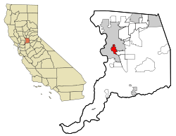
Location in Sacramento County and the state of California
|
|
| Country | |
| State | |
| County | Sacramento |
| Area | |
| • Total | 12.5 km2 (4.8 sq mi) |
| • Land | 12.5 km2 (4.8 sq mi) |
| • Water | 0 km2 (0 sq mi) |
| Population
(2000)
|
|
| • Total | 36,468 |
| • Density | 2,917/km2 (7,556/sq mi) |
| Time zone | UTC-8 (PST) |
| • Summer (DST) | UTC-7 (PDT) |
| ZIP code |
95824
|
| Area code(s) | 916, 279 |
| FIPS code | 06-55837 |
Parkway–South Sacramento was a special type of community in Sacramento County, California. It was called a "census-designated place" (CDP). This means it was an area identified by the government for counting people, but it wasn't an official city.
This area was part of the larger Sacramento Metropolitan Statistical Area. It shared borders with the City of Sacramento in three places. In the year 2000, about 36,468 people lived there.
Before the 2010 census, Parkway–South Sacramento was divided. Its land became parts of three new CDPs: Fruitridge Pocket, Lemon Hill, and Parkway.
Contents
History of Parkway–South Sacramento
The growth of South Sacramento as a developed area began with a major road. This road was once called U.S. Route 99, but it is now known as Stockton Boulevard.
Long ago, even before it was a U.S. highway, Stockton and Franklin boulevards were important routes. They stretched south from Downtown Sacramento. People used them to travel to Stockton and to reach farming areas, especially during the "gold mining" era.
Next, transportation improved with the arrival of railroads. The Southern Pacific Railroad and later the Western Pacific Railroad built tracks nearby in Florin.
In the 1940s, more homes were built in areas around South Sacramento. By the 1950s, new shopping centers appeared near Stockton Boulevard and Florin Road. More homes were also built in the Lindale and Florin areas. The area grew very quickly in the early 1960s. This was when the Florin Mall was built in South Sacramento. Growth slowed down in the late 1960s and early 1970s.
Where Was Parkway–South Sacramento?
Parkway–South Sacramento was located at coordinates 38.511657 degrees North and -121.452288 degrees West.
According to the United States Census Bureau, the area covered about 4.8 square miles (12.5 square kilometers). All of this area was land, with no water.
Population Facts
Here's how the population of Parkway–South Sacramento changed over the years:
| Historical population | |||
|---|---|---|---|
| Census | Pop. | %± | |
| 1970 | 28,574 | — | |
| 1980 | 26,815 | −6.2% | |
| 1990 | 31,903 | 19.0% | |
| 2000 | 36,468 | 14.3% | |
| source: | |||
In 2000, there were 36,468 people living in Parkway–South Sacramento. There were 11,197 households, which are groups of people living together in one home. Out of these, 8,207 were families.
The population was spread out across different age groups. About 35.5% of the people were under 18 years old. About 11.0% were between 18 and 24 years old. The median age, which is the middle age of all the people, was 27 years.
Neighboring Areas
 |
Sacramento | Sacramento | Sacramento |  |
| Sacramento | Florin | |||
| Sacramento | Elk Grove | Elk Grove |
See also
 In Spanish: Parkway-South Sacramento para niños

