Patharghata Upazila facts for kids
Quick facts for kids
Patharghata Upazila
পাথরঘাটা উপজেলা
|
|
|---|---|
|
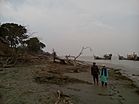
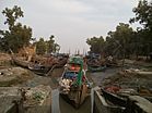
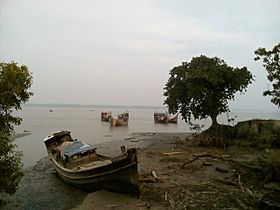
Skyline of Patharghata, Bangladesh
|
|
| Country | |
| Division | Barisal Division |
| District | Barguna District |
| Area | |
| • Total | 387.36 km2 (149.56 sq mi) |
| Population
(1991)
|
|
| • Total | 134,635 |
| • Density | 347.571/km2 (900.204/sq mi) |
| Time zone | UTC+6 (BST) |
| Website | Official Map of the Patharghata Upazila: http://lib.pmo.gov.bd/maps/images/barguna/Patharghata.gif |
Patharghata (which means "stone ghat" or "stone landing") is a special area in Bangladesh. It's called an Upazila, which is like a sub-district. Patharghata is part of the Barguna District and is located in the Barisal Division.
This area covers about 387.36 square kilometers. It's known for its natural beauty, including rivers and agricultural lands. Many people here are involved in fishing and farming.
Contents
Understanding Patharghata Upazila
Patharghata Upazila is a significant administrative area in Bangladesh. An Upazila is a local government unit, similar to a county or a borough in other countries. It helps manage local services and development for the people living there.
How Patharghata is Organized
Patharghata Upazila is divided into smaller parts to help with its administration. It has one main town area called Patharghata Municipality. It also has seven other areas known as union parishads.
A union parishad is the smallest rural administrative and local government unit in Bangladesh. Think of it as a group of villages working together.
Union Parishads of Patharghata
Here are the seven union parishads that make up Patharghata Upazila:
- Charduani
- Kakchira
- Kalmegha
- Kanthaltali
- Nachna Para
- Patharghata
- Raihanpur
Villages and Wards
These union parishads are further divided into 42 smaller areas called mauzas and 66 villages. A mauza is a type of administrative area, often a collection of villages.
The Patharghata Municipality, which is the main town, is also divided. It has 9 wards and 9 mahallas. A ward is a division within a city or town, and a mahalla is a specific neighborhood.
See also
 In Spanish: Patharghata para niños
 | Victor J. Glover |
 | Yvonne Cagle |
 | Jeanette Epps |
 | Bernard A. Harris Jr. |


