
Peddars Way facts for kids
Quick facts for kids Peddars Way |
|
|---|---|

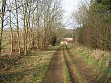
Peddars Way near Thompson
|
|
| Length | 74 km (46 mi) |
| Location | Suffolk and Norfolk |
| Designation | UK National Trail |
| Trailheads | Knettishall (near Thetford) 52°23′26″N 0°51′18″E / 52.3906°N 0.8549°E Holme-next-the-Sea 52°57′46″N 0°31′41″E / 52.9629°N 0.5281°E |
| Use | Walking |
| Lowest point | Holme-next-the-Sea |
| Difficulty | Easy |
| Season | All year round |
The Peddars Way is a long walking path in England. It goes through Suffolk and Norfolk counties. This path is great for hikers and people who love nature.
Contents
Discovering the Peddars Way
How Long is the Trail?
The Peddars Way is about 46 miles (74 kilometers) long. It follows the path of an old Roman road. Some people think it was an even older trackway. The Romans might have just improved it. The name "Peddars" probably comes from the Latin word pedester, which means "on foot." This path was first shown on a map in 1587.
The trail starts at Knettishall Heath in Suffolk. This is close to the border with Norfolk. It is about 7 kilometers east of Thetford. The path then goes north and ends at Holme-next-the-Sea. Here, it connects with another famous path.
Connecting Trails
The Peddars Way joins up with the Norfolk Coast Path. Together, they form the Peddars Way & Norfolk Coast Path National Trail. This combined trail is one of 15 National Trails in England and Wales. The two paths together are about 133 miles long.
The Peddars Way is also part of a bigger group of paths. These paths stretch all the way from Lyme Regis to Hunstanton. They are called the Greater Ridgeway. At Knettishall Heath, the Peddars Way also connects to the Icknield Way Path. This path goes for 110 miles southwest to Ivinghoe Beacon in Buckinghamshire.
Finding Your Way
Trail Guides and Signs
There is a special guide book for the Peddars Way. It has 144 pages and includes detailed maps. These maps are from the Ordnance Survey. The guide describes the path from south to north.
The trail is very easy to follow. There are many signs along the way. At path crossings, you will see wooden signs. These signs say "Peddars Way." In other places, you will see special discs. These discs are white, yellow, and green. They have an acorn symbol on them. This acorn symbol is used on many long-distance trails in England.
Getting There by Public Transport
Easy Access to the Trail
You can reach the Peddars Way using public transport. If you want to start at the southern end, there is a path. This path links Knettishall Heath to the nearby Harling Road railway station.
At the northern end, in Holme, you can catch a bus. There are regular bus services to King's Lynn and Hunstanton. Holme also has a bus service to Sheringham. From King's Lynn and Sheringham, you can easily connect to train services.
Folklore and Legends
The Ghostly Black Shuck
The Peddars Way has some interesting old stories. People used to say that the ghostly East Anglian hound Black Shuck haunted this path. Black Shuck is a mythical black dog. It is said to roam the countryside and coastal areas of East Anglia.
Images for kids
-
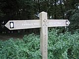
A signpost showing the way on the Peddars Way.
-
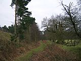
The start of the Peddars Way at Knettishall Heath.
-
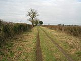
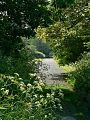
A view near Little Cressingham along the path.
-
The path crossing Massingham Heath.
-
A scenic spot near Fring on the trail.
-
The Peddars Way passing by Magazine Wood in Sedgeford.


