
Pedernales, Cabo Rojo, Puerto Rico facts for kids
Quick facts for kids
Pedernales
|
|||
|---|---|---|---|
|
Barrio
|
|||

Boulders in Laguna Guaniquilla
|
|||
|
|||

Location of Pedernales within the municipality of Cabo Rojo shown in red
|
|||

Pedernales, Cabo Rojo, Puerto Rico
Location in Caribbean
|
|||
| Commonwealth | |||
| Municipality | |||
| Area | |||
| • Total | 9.09 sq mi (23.5 km2) | ||
| • Land | 7.44 sq mi (19.3 km2) | ||
| • Water | 1.65 sq mi (4.3 km2) | ||
| Elevation | 89 ft (27 m) | ||
| Population
(2010)
|
|||
| • Total | 4,636 | ||
| • Density | 623.1/sq mi (240.6/km2) | ||
| Source: 2010 Census | |||
| Time zone | UTC−4 (AST) | ||
| ZIP code |
00623
|
||


Pedernales is a cool neighborhood, also known as a barrio, located in the town of Cabo Rojo, Puerto Rico. In 2010, about 4,636 people lived there.
A Look Back in Time
After the Spanish–American War, Spain gave Puerto Rico to the United States. This happened because of a peace agreement called the Treaty of Paris of 1898. Puerto Rico then became a special area connected to the U.S.
In 1899, the U.S. government counted everyone living in Puerto Rico. They found that 2,060 people lived in Pedernales at that time.
| Historical population | |||
|---|---|---|---|
| Census | Pop. | %± | |
| 1900 | 2,060 | — | |
| 1910 | 2,332 | 13.2% | |
| 1920 | 2,941 | 26.1% | |
| 1930 | 2,689 | −8.6% | |
| 1940 | 2,988 | 11.1% | |
| 1950 | 2,777 | −7.1% | |
| 1980 | 3,218 | — | |
| 1990 | 3,896 | 21.1% | |
| 2000 | 4,809 | 23.4% | |
| 2010 | 4,636 | −3.6% | |
| U.S. Decennial Census 1899 (shown as 1900) 1910-1930 1930-1950 1980-2000 2010 |
|||
Natural Wonders
Pedernales is home to the amazing Guaniquilla Natural Reserve. It's a special place where nature is protected.
You can also find huge boulders in the Guaniquilla Lagoon. These rocks are super old, dating back about 11 million years!
Images for kids
-
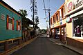
Shops in Pedernales, near Boquerón
.jpg)
See Also
- List of communities in Puerto Rico
 In Spanish: Pedernales (Cabo Rojo) para niños
