Pelham Islands facts for kids
 |
|
| Geography | |
|---|---|
| Location | Long Island Sound |
| Coordinates | 40°53′00″N 73°46′13″W / 40.883417°N 73.770231°W |
| Total islands | 10 |
| Major islands | 3 |
| Administration | |
|
United States
|
|
| State | |
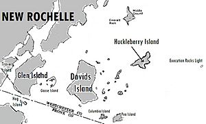
The Pelham Islands are a group of islands located in the western part of Long Island Sound. These islands have a long history, dating back to the 1600s. They were once owned by a man named Thomas Pell.
Contents
A Brief History of the Islands
In 1654, Thomas Pell bought the islands and a lot of the land around them from the Siwanoy Native American people. This large area became known as Pelham Manor. Over time, this huge piece of land was divided up. It eventually formed several towns and cities we know today. These include the Town and Village of Pelham, Pelham Manor, and the Town of Eastchester. It also includes parts of New Rochelle and Mount Vernon in Westchester County. Some areas like Pelham Bay and Eastchester in the Bronx are also part of this original land.
Later, in 1688, some of the Pelham Islands became part of New Rochelle. This happened after Jacob Leisler bought about 6,000 acres from the Pell family. The remaining islands became part of Bronx County in 1895. This was when the current border between Westchester and Bronx Counties was set up.
Exploring the Islands
The Pelham Islands include several interesting landforms. Some are still islands, while others have been connected to the mainland over time.
The Blauzes
The Blauzes are two small islands found in City Island Harbor. They are made of strong rock called Manhattan schist.
Chimney Sweeps Islands
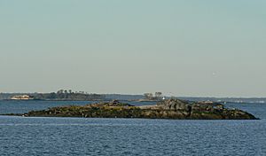
These are two small islands that no one lives on. They are made entirely of bedrock. The City of New York bought these islands in 1939. Now, they are part of Pelham Bay Park.
City Island
City Island is the largest of the Pelham Islands, covering about 235 acres. It was first called “Great Minnefords.” Before the American Revolutionary War, a man named Benjamin Palmer renamed it "City Island." He had big plans to turn it into a major port city. However, the Revolutionary War stopped these plans. City Island was part of the Town of Pelham until 1895. That's when the border between Westchester and Bronx Counties was created, placing City Island in Bronx County, New York City.
Davids Island
Davids Island is a 78-acre island located in New Rochelle. This island has been used for many different things throughout history. Early settlers used it as farmland. During the Civil War, it became a military hospital for injured soldiers. It was also a U.S. Army Fort called Fort Slocum. Later, during the Cold War, it was a "Nike" missile site for air defense.
Goose Island
Goose Island is a group of rocky areas located in New Rochelle.
Hart Island
Hart Island, originally known as “Little Minnefords,” is a 101-acre island. It lies just off the eastern shore of City Island. During the Civil War, the government used it as a training facility. The City of New York bought Hart Island in 1868. Since then, it has been used for many purposes. It was a place to keep people with Yellow Fever during an epidemic. It was also a reform school for boys and a home for German prisoners of war during World War II. Like Davids Island, it also had a "Nike" missile site during the Cold War. Today, it is the city's main public burial ground, often used for people who do not have families or cannot afford private burials.
High Island
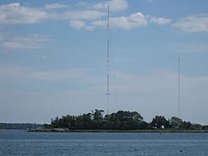
High Island is an 8-acre island. In 1762, Captain John Wooley bought it and named it "High Island" because of its raised center. In 1962, a radio broadcasting company bought the island. They built a bridge to connect it to City Island. Today, radio stations WCBS and WFAN use a 529-foot antenna tower on the island for broadcasting.
Hunter Island
Hunter Island was once the country home of a rich New York City merchant named John Hunter in the 1800s. When Pelham Bay Park was developed in 1937, the water between Hunter's Island and the land near City Island Bridge was filled in. This turned the island into a peninsula, meaning it's now connected to the mainland.
Rat Island
Rat Island is a small island, about 2.5 acres in size. It has been used for different things over the years. It was once a hospital for people with typhoid fever. It also served as a place for artists and writers to live and work. Sometimes, fishermen would use it as a campsite.
Travers Island
Travers Island used to be an island, but it is now connected to mainland New Rochelle by filled-in land. It is the summer home of the New York Athletic Club.
Twin Island
Twin Island was another island that was connected to Rodman's Neck by filled-in land in the 1930s. It is now part of Orchard Beach in Pelham Bay Park.
 | Selma Burke |
 | Pauline Powell Burns |
 | Frederick J. Brown |
 | Robert Blackburn |


