Petit lac Jacques-Cartier facts for kids
Quick facts for kids Petit lac Jacques-Cartier |
|
|---|---|
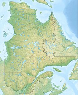
| Location | Lac-Jacques-Cartier (TNO), La Côte-de-Beaupré Regional County Municipality, Capitale-Nationale |
| Coordinates | 47°24′26″N 71°31′48″W / 47.40722°N 71.53°W |
| Lake type | Natural |
| Primary inflows | (clockwise from the mouth) Décharge des lacs Collins, Poitevin et Mesy, décharge des lacs Haltère et Garneau, décharge du lac Lairet, décharge du lac Doux. |
| Primary outflows | Rivière Jacques-Cartier Sud |
| Basin countries | Canada |
| Max. length | 3.9 km (2.4 mi) |
| Max. width | 1.75 km (1.09 mi) |
| Surface elevation | 674 m (2,211 ft) |
The Petit lac Jacques-Cartier is a beautiful freshwater lake in Quebec, Canada. It flows into the rivière Jacques-Cartier Sud. This lake is found in a special area called Lac-Jacques-Cartier. It is also part of the Jacques-Cartier National Park.
This area is important for two main reasons. First, people work in forestry, which means they manage and harvest trees. Second, it's a popular spot for recreational tourism. This includes activities like hiking, fishing, and enjoying nature.
The lake's surface usually freezes over from early December to late March. It's generally safe to walk or play on the ice from mid-December to mid-March.
Contents
Lake Location and Features
The Petit lac Jacques-Cartier is surrounded by mountains. It is about 3.9 kilometres (2.4 mi) long and 1.75 kilometres (1.09 mi) wide. The lake sits at an elevation of 674 metres (2,211 ft) above sea level.
This lake has two small islands and one larger island in the middle. This central island is long and narrow, running from north to south. Two peninsulas also stretch into the lake.
Water Sources for the Lake
The lake gets its water from several smaller lakes. These include:
- Water flowing from Collins, Poitevin, and Mesy lakes.
- Water flowing from Haltère and Garneau lakes.
- Water flowing from Lairet lake.
- Water flowing from Doux lake.
Where the Lake's Water Goes
The water from Petit lac Jacques-Cartier flows out through a dam located in a small bay on the northeast side. From there, the water travels a long way:
- It flows north along the rivière Jacques-Cartier Sud.
- Then, it goes east down the rivière Jacques-Cartier Nord-Ouest.
- Finally, it flows south along the main Jacques-Cartier River until it reaches the big Saint-Laurent River.
Who Was Jacques Cartier?
The lake is named after a famous explorer, Jacques Cartier. He was born in Saint-Malo, France, in 1491. He was a navigator and explorer who made three important trips to Canada between 1534 and 1542.
Cartier's Explorations
- First Trip (1534): King François I of France sent Cartier to find a passage to Asia. He explored Anticosti Island and the Gulf of St. Lawrence. On July 24, he put up a cross in Gaspé Bay to claim the land for France.
- Second Trip (1535): Cartier sailed up the St. Lawrence River. He reached a place called Hochelaga (which is now Montreal). He spent a very tough winter in Stadaconé (now Quebec City).
- Third Trip (1541): This time, Cartier tried to start the first French colony in America. He settled at the mouth of the Cap-Rouge river, naming it Charlesbourg-Royal. However, he left the colony in June 1542. He met Roberval, who was on his way to Canada, in Newfoundland. Cartier decided to return to France.
Jacques Cartier was the first person to map the St. Lawrence River. He also realized that the "gold" and "diamonds" he found were actually just iron pyrite and quartz, which look like gold and diamonds but are not valuable.
The name "Petit lac Jacques-Cartier" was officially given to the lake on December 5, 1968, by the Commission de toponymie du Québec.
 | Isaac Myers |
 | D. Hamilton Jackson |
 | A. Philip Randolph |


