Petticoat Creek facts for kids
Quick facts for kids Petticoat Creek |
|
|---|---|

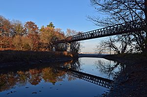
Mouth of Petticoat Creek.
|
|
|
Location of the mouth of Petticoat Creek in Southern Ontario
|
|
| Country | Canada |
| Province | Ontario |
| Region | Greater Toronto Area |
| Municipalities | |
| Physical characteristics | |
| Main source | Confluence of two unnamed streams Markham 195 m (640 ft) 43°52′45″N 79°11′22″W / 43.87922394143364°N 79.18946912657846°W |
| River mouth | Lake Ontario Pickering 74 m (243 ft) 43°48′15″N 79°06′15″W / 43.80417°N 79.10417°W |
| Basin features | |
| River system | Great Lakes Basin |
| Basin size | 26.77 km2 (10.34 sq mi) |
Petticoat Creek is a small stream located in the Greater Toronto Area of Ontario, Canada. It flows through the cities of Pickering, Toronto, and Markham. This creek is part of the larger Great Lakes Basin, which means its waters eventually flow into the Great Lakes. It is a tributary of Lake Ontario, meaning it flows into Lake Ontario.
The creek and its surrounding area are managed by the Toronto and Region Conservation Authority (TRCA). This organization helps protect and restore natural areas. The entire area that drains water into Petticoat Creek, called its watershed, covers about 26.77 square kilometers (10.34 square miles). If you add up the length of all its different branches, the creek system is about 49 kilometers (30 miles) long.
Contents
Understanding the Petticoat Creek Watershed
A watershed is like a giant bowl where all the rain and snowmelt collect and drain into a specific river or stream. For Petticoat Creek, the land use in its watershed is divided into different types. About 52% of the land is used for farming, 27% is protected green space (like parks and natural areas), and 21% is urban, meaning it has buildings and roads.
How the Land Shapes the Creek
The land around Petticoat Creek is mostly a type of landscape called the "South Slope." This area is a smooth, gently rolling plain made of till (a mix of clay, sand, and rocks left behind by glaciers). It also has faint drumlins, which are small, oval-shaped hills formed by glaciers.
Where Does the Water Come From?
The amount of water flowing in Petticoat Creek can change a lot. The upper parts of the creek, closer to where it starts, don't get water from a large underground source like the Oak Ridges Moraine. This means the water flow there depends mostly on rain and snow. So, sometimes these parts of the creek might dry up if there hasn't been much rain.
However, the lower parts of the creek, closer to Lake Ontario, have a more steady water flow. This is because these sections are below the ancient shoreline of glacial Lake Iroquois. This was a much larger lake that existed thousands of years ago after the last ice age. The land here has different soil types that help keep the water flowing more consistently.
Petticoat Creek Conservation Area
The Petticoat Creek Conservation Area is a special place located right where the creek meets Lake Ontario. It's a popular spot for people to enjoy nature. This area is managed by the Toronto and Region Conservation Authority (TRCA). It used to be managed by its own group, the Petticoat Creek Conservation Authority, but that group joined with the TRCA to work together.
At the conservation area, you can find many outdoor activities. It's a great place for picnics, swimming, and enjoying the natural beauty of the lake and the creek. It helps protect the natural environment and provides a green space for everyone to visit.
 | Delilah Pierce |
 | Gordon Parks |
 | Augusta Savage |
 | Charles Ethan Porter |


