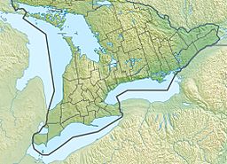
Pewee Lake (Ontario) facts for kids
Quick facts for kids Pewee Lake |
|
|---|---|
| Location | Nipissing District, Ontario |
| Coordinates | 45°34′18″N 78°31′29″W / 45.57167°N 78.52472°W |
| Part of | Saint Lawrence River drainage basin |
| Basin countries | Canada |
| Max. length | 260 m (850 ft) |
| Max. width | 140 m (460 ft) |
| Surface elevation | 401 m (1,316 ft) |
Pewee Lake is a small but interesting lake located in the beautiful Nipissing District of Ontario, Canada. It's nestled right inside Algonquin Provincial Park, a very famous and popular park. This lake is also part of a huge water system called the Saint Lawrence River drainage basin, which means its water eventually flows all the way to the Atlantic Ocean! You can even find it right beside Ontario Highway 60, making it easy to spot.
Contents
Where Pewee Lake's Water Goes
Pewee Lake is like a small stop on a long journey for water. It gets its water from a stream that flows into its southern side. Then, the water leaves the lake from another stream on its northern side.
The Water's Journey to the Ocean
The water from Pewee Lake doesn't stay put for long! It flows into Mew Lake nearby. From there, it travels through a series of rivers:
- First, it goes into Jack Creek.
- Then, it joins the North Madawaska River.
- Next, it flows into the larger Madawaska River.
- Finally, it reaches the mighty Ottawa River.
- The Ottawa River then carries the water all the way to the Saint Lawrence River, which eventually empties into the Atlantic Ocean.
Pewee Lake sits at an elevation of about 401 metres (1,316 ft) (or 1,316 feet) above sea level.
Fun Things to Do Near Pewee Lake
Pewee Lake is a great spot for outdoor adventures, especially since it's in Algonquin Provincial Park.
Hiking and Backpacking Trails
If you love hiking, you're in luck! The start of the Highland Backpacking Trail is very close to Pewee Lake. You can find it right off Highway 60, on the north side of the lake. This trail offers two different loops for hikers:
- A shorter loop that is 19-kilometre (12 mi) long.
- A longer loop that stretches for 35-kilometre (22 mi).
These trails are perfect for exploring the park's wilderness and enjoying nature.
Camping at Mew Lake
Right next to Pewee Lake, on its northeast side, is the Mew Lake Campground. This is a popular spot for families and friends to set up tents or park RVs. It's a convenient place to stay if you want to explore Pewee Lake, go hiking, or enjoy other activities in Algonquin Park.


