Picacho del Diablo facts for kids
Quick facts for kids Picacho del Diablo |
|
|---|---|
| Cerro de la Encantada | |

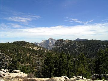
Picacho del Diablo as seen from the National Astronomical Observatory of Mexico
|
|
| Highest point | |
| Elevation | 3,096 m (10,157 ft) |
| Prominence | 2,115 m (6,939 ft) |
| Listing |
|
| Naming | |
| English translation | Devil's Peak |
| Language of name | Spanish |
| Geography | |
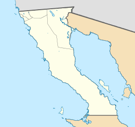
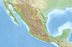
| Location | Sierra de San Pedro Mártir National Park, Mexicali Municipality, Baja California, Mexico |
| Parent range | Sierra San Pedro Mártir |
| Topo map | H11B45 San Rafael |
| Climbing | |
| Easiest route | class 3 scramble |
Picacho del Diablo is a very tall mountain in Mexico. Its name means 'Devil's Peak' in Spanish. It is the highest point on the Baja California peninsula, standing at about 3,096 meters (10,157 feet) tall.
Another name for this mountain is Cerro de la Encantada. This means 'Hill of the Enchanted' or 'Hill of the Bewitched'. The mountain is found in the Sierra de San Pedro Mártir mountain range. This range is part of the larger Peninsular Ranges in the Mexican state of Baja California.
Mountain Climate
The weather on Picacho del Diablo can be quite cold, especially in winter. It often has a climate where summers are cool and winters are cold and wet. This is similar to some subarctic climates, but with a Mediterranean influence.
The mountain gets a lot of rain and snow, especially from January to March. Summers are drier, but there can still be some rain in July and August. Temperatures can drop below freezing in winter months, while summer temperatures are much milder.
| Climate data for Picacho del Diablo Peak (1961–1990) | |||||||||||||
|---|---|---|---|---|---|---|---|---|---|---|---|---|---|
| Month | Jan | Feb | Mar | Apr | May | Jun | Jul | Aug | Sep | Oct | Nov | Dec | Year |
| Mean daily maximum °C (°F) | 4.9 (40.8) |
4.5 (40.1) |
3.9 (39.0) |
6.4 (43.5) |
10.1 (50.2) |
16.4 (61.5) |
19.7 (67.5) |
18.5 (65.3) |
16.5 (61.7) |
12.0 (53.6) |
7.2 (45.0) |
5.7 (42.3) |
10.48 (50.86) |
| Daily mean °C (°F) | 0.3 (32.5) |
0.0 (32.0) |
−0.9 (30.4) |
0.8 (33.4) |
4.2 (39.6) |
9.5 (49.1) |
13.0 (55.4) |
12.1 (53.8) |
10.3 (50.5) |
6.6 (43.9) |
2.2 (36.0) |
1.1 (34.0) |
4.9 (40.8) |
| Mean daily minimum °C (°F) | −4.3 (24.3) |
−4.6 (23.7) |
−5.8 (21.6) |
−4.7 (23.5) |
−1.8 (28.8) |
2.6 (36.7) |
6.4 (43.5) |
5.6 (42.1) |
4.0 (39.2) |
1.3 (34.3) |
−2.8 (27.0) |
−3.5 (25.7) |
−0.6 (30.9) |
| Average precipitation mm (inches) | 189 (7.4) |
144 (5.7) |
169 (6.7) |
11 (0.4) |
9 (0.4) |
3 (0.1) |
61 (2.4) |
55 (2.2) |
50 (2.0) |
20 (0.8) |
59 (2.3) |
80 (3.1) |
850 (33.5) |
| Source: climatewna.com | |||||||||||||
More About Mountains
- List of mountains in Mexico
- Mountain peaks of North America
- List of Ultras of Mexico
 In Spanish: Cerro de La Encantada (México) para niños
 | Valerie Thomas |
 | Frederick McKinley Jones |
 | George Edward Alcorn Jr. |
 | Thomas Mensah |


