Picture Rock Pass facts for kids
Quick facts for kids Picture Rock Pass |
|
|---|---|

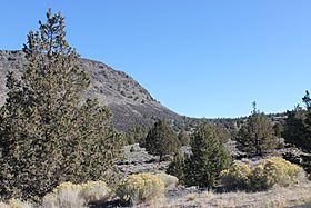
North side of Picture Rock Pass
|
|
| Elevation | 4,830 ft (1,472 m) |
| Traversed by | |
| Location | Lake County, Oregon, United States |
| Coordinates | 43°02′52″N 120°47′56″W / 43.047816°N 120.798798°W |
Picture Rock Pass is a mountain pass located in Oregon, USA. It's a high point where Oregon Route 31 crosses over a mountain range. The pass is about 4,830 feet (1,472 meters) above sea level.
You can find Picture Rock Pass in Lake County, Oregon. It sits between the small towns of Silver Lake and Paisley.
What is Picture Rock Pass?
This pass is an important natural landmark. It helps separate two large lakes: Silver Lake and Summer Lake. These lakes and the land that drains into them are part of a much larger area. This area is known as the Great Basin. The Great Basin is a huge dry region in the western United States. Picture Rock Pass is located in the northwestern part of this big basin.
How Picture Rock Pass Got Its Name
The name "Picture Rock Pass" comes from something very special. There are ancient rock carvings found on rocks just south of the highway. These carvings are called petroglyphs. They were made by early people who lived in the area a long time ago. These amazing rock pictures are part of a place known as the Picture Rock Pass Petroglyphs Site.

