Pillar Point Air Force Station facts for kids

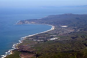
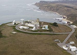
Pillar Point Military Reservation, later known as Pillar Point Air Force Station, is a special place used by the United States Armed Forces. It covers about 48 acres and sits high above Pillar Point Harbor in California. This important site is about 15 miles south of San Francisco in San Mateo County.
Contents
Protecting the Coastline During World War II
Pillar Point was first set up on October 10, 1940. It was built during World War II to help protect the San Francisco area. People were worried that Japan might attack San Francisco.
To defend the coast, the military placed many things at Pillar Point:
- Large artillery guns
- .50-caliber machine guns to shoot down enemy planes
- Bright searchlights to spot ships or planes at night
- Barracks for soldiers to live in
- Strong concrete bunkers for protection
- Fences and an electric system for security
In June 1944, a special radar system was installed. This radar, called SCR-296, was built by Western Electric Company. It could find and track ships moving on the ocean.
From War to Space: Tracking Missiles and Satellites
After World War II ended, the radar system was taken away on January 17, 1946. The military base then closed in 1949.
Reopening for Missile Tracking
The US Navy reopened the base on September 4, 1959. It became a station for tracking missiles. First, it supported the Naval Air Station Point Mugu's Regulus missile program. Later, it tracked Minuteman missiles.
In the 1960s, the base was given to the US Air Force. They continued to use it as a missile tracking station. From 1967 to 1972, the station tracked Minuteman II missiles.
Modern Tracking and Space Force
Today, Pillar Point uses modern radar systems like AN/FPQ-6 and AN/MPS-36. These radars are part of the Western Range (USSF) from Vandenberg Air Force Base.
Currently, the United States Space Force uses Pillar Point. They track satellites that orbit the Earth over the poles. They also track intercontinental ballistic missiles launched from Vandenberg. The United States Navy and the United States Air Force Special Operations Command also use the facility.
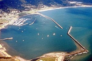
To help protect the harbor, two breakwaters were built. One was added in 1961, and a second one in 1982.
Where is Pillar Point?
Pillar Point is a small piece of land. It is about 0.3 miles wide and 0.25 miles long. Its elevation, or height above sea level, ranges from 80 to 180 feet. A narrow strip of land connects the point to the main coast on its northeastern side.
Pillar Point Air Force Station was once part of a large ranch called Rancho Corral de Tierra. Just north of the base was the Half Moon Bay Flight Strip. This was a small airfield used for training during World War II by the Salinas Army Air Base. Today, the Half Moon Bay Flight Strip is known as Eddie Andreini Sr. Airfield.
Ancient History at the Station
There is a very old site at the station where prehistoric artifacts have been found. This site is called CA-SMA-151. It is important enough to be listed on the National Register of Historic Places.
 | Frances Mary Albrier |
 | Whitney Young |
 | Muhammad Ali |


