Pine Point, South Australia facts for kids
Quick facts for kids Pine PointSouth Australia |
|||||||||||||||
|---|---|---|---|---|---|---|---|---|---|---|---|---|---|---|---|

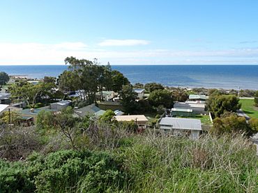
Beachside shacks at Pine Point
|
|||||||||||||||
| Established | 24 January 1874 (town) May 1999 (locality) |
||||||||||||||
| Postcode(s) | 5571 | ||||||||||||||
| LGA(s) | Yorke Peninsula Council | ||||||||||||||
| Region | Yorke and Mid North | ||||||||||||||
| County | Fergusson | ||||||||||||||
| State electorate(s) | Narungga | ||||||||||||||
| Federal Division(s) | Grey | ||||||||||||||
|
|||||||||||||||
| Footnotes | Adjoining localities | ||||||||||||||
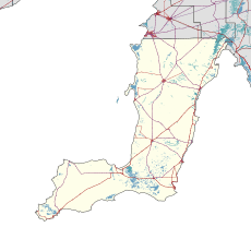
Pine Point is a small place in South Australia. It is located south of Ardrossan. You can find it on the eastern side of the Yorke Peninsula. This area is right next to the beautiful Gulf St Vincent.
Contents
What is Pine Point?
Pine Point is known as a "locality." This means it's a specific area, not a big city. It includes the "Pine Point Shack Site." These are small beach houses, often used for holidays. It also includes the original "Government Town of Pine Point."
A Name Change Story
Pine Point was first surveyed as a government town in 1883. It was officially named Muloowurtie on January 24, 1884. But later, in 1940, its name was changed. It became the Pine Point we know today. The current boundaries for the locality were set in May 1999. This was done to keep the "long established name" of Pine Point.
Where is Pine Point Located?
Pine Point is on the Yorke Peninsula. This peninsula is a popular spot in South Australia. It sits right on the coast of Gulf St Vincent. This gulf is a large inlet of the sea. It offers lovely views and access to the water.
What Can You See in Pine Point?
The area is known for its beachside shacks. These are simple homes right by the water. People often use them for fishing trips or relaxing holidays. The image shows some of these charming shacks. They are a big part of Pine Point's character.
 | Anna J. Cooper |
 | Mary McLeod Bethune |
 | Lillie Mae Bradford |


