Pinopolis, South Carolina facts for kids
Quick facts for kids
Pinopolis, South Carolina
|
|
|---|---|

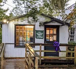
Pinopolis Post Office
|
|
| Country | United States |
| State | South Carolina |
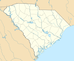
| County | Berkeley |
| Area | |
| • Total | 1.43 sq mi (3.71 km2) |
| • Land | 1.43 sq mi (3.71 km2) |
| • Water | 0.00 sq mi (0.00 km2) |
| Elevation | 91 ft (28 m) |
| Population
(2020)
|
|
| • Total | 982 |
| • Density | 685.75/sq mi (264.77/km2) |
| Time zone | UTC-5 (Eastern (EST)) |
| • Summer (DST) | UTC-4 (EDT) |
| ZIP code |
29469
|
| Area code(s) | 843 and 854 |
| FIPS code | 45-57175 |
Pinopolis is a small community in Berkeley County, South Carolina, United States. It is not an official city or town. Instead, it is called a census-designated place. This means it is an area that the government counts for population statistics. In 2010, about 948 people lived there. By 2020, the population grew slightly to 982.
Contents
Pinopolis Population Facts
The word "demographics" means facts about a population. This includes how many people live somewhere. It also covers things like age, gender, and how many families there are.
| Historical population | |||
|---|---|---|---|
| Census | Pop. | %± | |
| 2020 | 982 | — | |
| U.S. Decennial Census | |||
The History of Pinopolis
Pinopolis has an interesting past. It was founded around 1845. The area was chosen because it was higher up than other parts of South Carolina. This made it a good place to escape mosquitoes and the very hot weather.
Why the Name Pinopolis?
A person living there came up with the name "Pinopolis." They noticed there were many pine trees in the area. The name "Pinopolis" likely comes from Greek and Latin words. "Pino" sounds like "pine," and "polis" means "city" or "community."
Pinopolis Before and After the Civil War
Before the American Civil War, Pinopolis was a refined and polished place. Wealthy people gathered there. After the Civil War, things changed in the South. Pinopolis became important for another reason. It was home to the first elementary school for black students in the area.
How Lake Moultrie Was Formed
In 1939, a big project called the Santee Cooper Project began. Workers built a dam on the Santee River. This created a huge lake called Lake Moultrie. The Pinopolis Dam was finished in 1946. About 175,000 acres (708 square kilometers) of land were flooded.
Because Pinopolis is on higher ground, it was saved from the flood. Now, it sits like a peninsula reaching into Lake Moultrie. This means it is almost surrounded by water.
Historic Places in Pinopolis
Several places in Pinopolis are very old and important. They are listed on the National Register of Historic Places. These include the Pinopolis Historic District North, the Pinopolis Historic District South, and the William Robertson House. These places help us remember the community's long history.
See also
 In Spanish: Pinopolis para niños
 | Jewel Prestage |
 | Ella Baker |
 | Fannie Lou Hamer |


