
Pipp Brook facts for kids
Quick facts for kids Pipp Brook |
|
|---|---|

Pipp Brook Mill Pond, Dorking
|
|
| Country | England |
| County | Surrey |
| District | Mole Valley |
| Physical characteristics | |
| Main source | Mag's Well Leith Hill, Surrey 219 m (719 ft) 51°11′51″N 0°21′46″W / 51.1975°N 0.3628°W |
| River mouth | River Mole Pixham 43 m (141 ft) 51°14′39″N 0°19′08″W / 51.2443°N 0.3189°W |
| Length | 9.5 km (5.9 mi) |
| Basin features | |
| Tributaries |
|
The Pipp Brook is a small river in Surrey, England. It flows into the River Mole. The Pipp Brook starts from two main springs (natural water sources) north of Leith Hill. This area is part of the Greensand Ridge.
The river flows downhill towards the north. Then, it turns east and runs along a valley called the Vale of Holmesdale. It passes north of Dorking High Street before joining the River Mole at a place called Pixham. The Milton Brook is the main stream that flows into the Pipp Brook.
Contents
River's Journey
Where the River Starts
The Pipp Brook begins in a few spots:
- One source is southwest of Waterden Wood, near Crockers Farm in Coldharbour, Surrey. 51°11′08″N 0°21′13″W / 51.1856°N 0.3535°W
- Another important source is Mag's Well. 51°11′51″N 0°21′46″W / 51.1974°N 0.3628°W This well is about 500 meters northeast of Leith Hill Tower.
The water from Mag's Well flows north. It forms one of many small valleys in the forest that covers the northern slopes of Leith Hill. This area is called Wotton Common. A longer stream, the River Tillingbourne, also starts nearby.
The main stream that feeds the Pipp Brook is the Milton Brook. It starts from three close points in the farmland on the northeast edge of the forest.
The River's Path
Both the Pipp Brook and the larger River Tillingbourne collect water from the northern slopes of Leith Hill. The area between these two rivers marks the border between Westcott and Wotton.
The Pipp Brook flows mostly east as it goes through Dorking. It runs north of the town and south of the steep hills of the North Downs at Ranmore Common. Finally, it joins the River Mole at Pixham.
Old Watermills
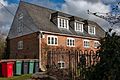
For a long time, people used the power of the Pipp Brook to run watermills. By the 1800s, there were six grain mills along the river. These mills were named Rookery, Westcott, Milton Court, Parsonage, Pipp Brook, and Pixham Mills.
These mills were used to grind grain into flour. However, by the mid-1900s, they were no longer used. This was because bread production became more commercial, and new ways of making bread meant these local mills were not needed as much.
River Health
The Environment Agency checks the health of rivers in England. They give each river an overall "ecological status." This status tells us how healthy the river's environment is. There are five levels: high, good, moderate, poor, and bad.
To figure out the status, they look at different things:
- Biological status: This checks the types and numbers of living things in the river, like small creatures (invertebrates), plants, and fish.
- Chemical status: This checks if there are any harmful chemicals in the water. They compare the levels of chemicals to safe amounts.
The chemical status is either "good" or "fail" (meaning it's not good).
Here's what the Pipp Brook's water quality was like in 2019:
| Section | Ecological Status |
Chemical Status |
Overall Status |
Length | Catchment | Channel |
|---|---|---|---|---|---|---|
| Pipp Brook | Poor | Fail | Poor | 12.164 km (7.558 mi) | 20.965 km2 (8.095 sq mi) | Heavily modified |
The table shows that in 2019, the Pipp Brook's water quality was rated "poor" overall. This means it needs improvement to be healthier for the plants and animals that live there. "Heavily modified" means that the river's natural shape or flow has been changed by human activities, like building banks or bridges.
Images for kids
-
Pippbrook Mill in Dorking

