Plainfield, Indiana facts for kids
Quick facts for kids
Plainfield, Indiana
|
||
|---|---|---|
|
Town
|
||
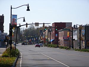
Plainfield Town Center
|
||
|
||
| Motto(s):
"A Community of Values"
|
||
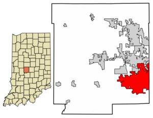
Location of Plainfield in Hendricks County, Indiana.
|
||
| Country | United States | |
| State | Indiana | |
| County | Hendricks | |
| Township | Guilford, Liberty, Washington | |
| Incorporated | 1839 | |
| Government | ||
| • Type | Town council | |
| Area | ||
| • Total | 26.12 sq mi (67.66 km2) | |
| • Land | 26.00 sq mi (67.33 km2) | |
| • Water | 0.13 sq mi (0.33 km2) | |
| Elevation | 745 ft (227 m) | |
| Population
(2020)
|
||
| • Total | 34,625 | |
| • Density | 1,331.99/sq mi (514.28/km2) | |
| Time zone | UTC−5 (EST) | |
| • Summer (DST) | UTC−4 (EDT) | |
| ZIP code |
46168
|
|
| Area code(s) | 317/463 | |
| FIPS code | 18-60246 | |
| GNIS feature ID | 2396859 | |
Plainfield is a town located in Hendricks County, Indiana, United States. It is part of three different townships: Guilford, Liberty, and Washington. In 2010, about 27,631 people lived here. By 2022, the number of people was estimated to be around 36,074.
Contents
Plainfield's History
Plainfield's story began in 1822 when Jeremiah Hadley bought the land. Ten years later, his son Elias Hadley took over. In 1839, Elias Hadley and Levi Jessup officially planned out the town. This is also when Plainfield became an incorporated town.
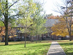
The town got its name from the early settlers called Friends, also known as Quakers. These "plain" people built many meetinghouses in the area. One important meetinghouse was the Western Yearly Meeting of Friends in Plainfield. Even today, the local high school honors the Quakers by using their name for the school's mascot.
Plainfield is well-known for being on the National Road, also called U.S. Route 40. This road runs right through the town as Main Street.
The Van Buren Elm Incident
In 1842, something funny happened in Plainfield that made national news. Former President Martin Van Buren was traveling through town in a stagecoach. People were upset because he had stopped a bill to improve the highway. So, a group of people played a trick on him. They caused his stagecoach to get stuck and tip over in the thick mud of the road!
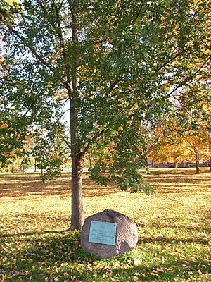
The elm tree whose roots caused the carriage to fall became known as the Van Buren Elm. Today, an elementary school near this spot is named Van Buren Elementary School.
In the 1980s, Plainfield became the main office for the Islamic Society of North America.
Plainfield's Geography
Plainfield covers about 22.38 square miles (57.96 square kilometers) of land. Most of this area is land, with only a small part being water.
The town is in a flat area of the United States called the Central Till Plains. There are a few small hills. The area has a mix of deciduous forests and prairie grasslands. White Lick Creek, which flows into the White River, runs through the western part of Plainfield. On the eastern side, Clark's Creek flows south and joins White Lick Creek.
Plainfield's Population
Plainfield has grown quite a bit over the years. Here's how its population has changed:
| Historical population | |||
|---|---|---|---|
| Census | Pop. | %± | |
| 1850 | 251 | — | |
| 1870 | 795 | — | |
| 1880 | 50 | −93.7% | |
| 1890 | 909 | 1,718.0% | |
| 1910 | 1,303 | — | |
| 1920 | 1,373 | 5.4% | |
| 1930 | 1,617 | 17.8% | |
| 1940 | 1,811 | 12.0% | |
| 1950 | 2,585 | 42.7% | |
| 1960 | 5,460 | 111.2% | |
| 1970 | 8,211 | 50.4% | |
| 1980 | 9,191 | 11.9% | |
| 1990 | 10,433 | 13.5% | |
| 2000 | 18,396 | 76.3% | |
| 2010 | 27,631 | 50.2% | |
| 2020 | 34,625 | 25.3% | |
| Source: US Census Bureau | |||
Plainfield in 2010
In 2010, there were 27,631 people living in Plainfield. There were 9,747 households, which are groups of people living together. The average age of people in the town was 35.5 years old. About 24.5% of the residents were under 18 years old.
Plainfield's Economy
Plainfield has a large warehouse district on its east side. This area is close to the Indianapolis International Airport. It employs about 5,000 people. This makes up about half of all warehouse jobs in central Indiana.
"The Shops at Perry Crossing" is a big outdoor shopping mall in Plainfield. It covers 600,000 square feet (55,742 square meters).
The Plainfield Correctional Facility is a prison located in the western part of Plainfield. In 2019, it held 1,497 inmates and had 341 staff members.
Arts and Culture in Plainfield
Plainfield has a public library called the Plainfield-Guilford Township Public Library. It offers books and resources for everyone.
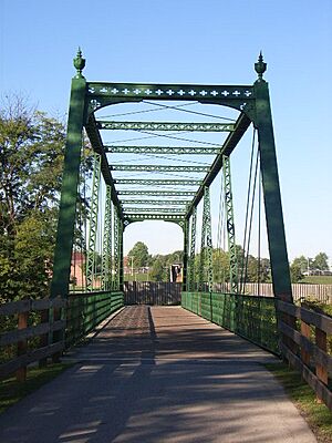
Several important places in Plainfield are listed on the National Register of Historic Places. These include the Hendricks County Bridge Number 316, the Plainfield Historic District, and the THI and E Interurban Depot-Substation.
Parks and Recreation in Plainfield
Plainfield has about 20 miles (32 kilometers) of trails for walking and biking. The eastern part of the Vandalia Trail uses old sections of the former Vandalia Railroad.
The Richard A. Carlucci Recreation and Aquatic Center is a large recreation facility. It has basketball courts, an indoor track, a waterpark, a fitness center, and an indoor play area.
Hummel Park is a big park that covers 205 acres (83 hectares). It has sports fields, basketball and volleyball courts, baseball diamonds, and nature trails. You can also fish in its lakes. The park features an amphitheater and a 300-foot (91-meter) wooden bridge over White Lick Creek.
Education in Plainfield
Plainfield offers many educational opportunities for students.
Higher Education
Plainfield has a satellite campus of Ivy Tech Community College. This campus is connected to the main campus in Indianapolis.
Public Schools in Plainfield
The public schools in Plainfield are managed by the Plainfield Community School Corporation. These schools include:
- Guilford Elementary School
- Brentwood Elementary School
- Central Elementary School
- Van Buren Elementary School
- Clarks Creek Elementary School
- Plainfield Community Middle School
- Plainfield High School
Private Schools in Plainfield
St. Susanna Catholic School is a private school in Plainfield. It is run by St. Susanna Catholic Church.
Plainfield's Infrastructure
Transportation in Plainfield
Plainfield has good transportation links, making it easy to get around.
Bus Transit
The Central Indiana Regional Transportation Authority runs a bus service. This bus helps people get to major employers in the town.
Highways
 Interstate 70 runs along the southern edge of Plainfield. It goes from east to west.
 US 40 is also known as the Historic National Road. It passes through the center of Plainfield and is the main road running east to west. Plainfield's town center is where US 40 meets Center Street.
 State Road 267 (former) - Quaker Boulevard is Plainfield's main north-south road. It used to be State Road 267.
- Ronald Reagan Parkway is another important north-south road on the east side of Plainfield.
Airports
The Indianapolis International Airport is located just east of Plainfield. The Hendricks County Airport is about 5 miles (8 kilometers) northwest of Plainfield.
Notable People from Plainfield
Many interesting people have connections to Plainfield:
- Mark Hampton, a famous interior designer.
- Del Harris, a basketball coach.
- Lawson Harvey, a Justice of the Indiana Supreme Court.
- James Hurst, an offensive lineman for the New Orleans Saints.
- Ron McQueeney, director of photography at Indianapolis Motor Speedway.
- Chris Stout, who founded the Center for Global Initiatives.
- Forrest Tucker, an actor.
- Patricia "Pat" Williams, a comedian.
- Babar and Haris Suleman, a father-son pilot team.
See also
 In Spanish: Plainfield (Indiana) para niños
 | Stephanie Wilson |
 | Charles Bolden |
 | Ronald McNair |
 | Frederick D. Gregory |


