Poachie Range facts for kids
Quick facts for kids Poachie Range |
|
|---|---|

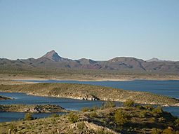
Alamo Lake
|
|
| Highest point | |
| Peak | Arrastra Mountain |
| Elevation | 4,807 ft (1,465 m) |
| Dimensions | |
| Length | 28 mi (45 km) (E-W) |
| Width | 8 mi (13 km) |
| Geography | |
| Country | United States |
| Settlements | Wikieup and Nothing |
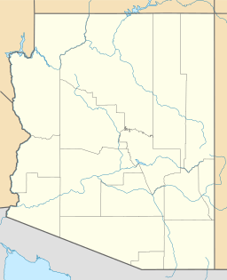
| Range coordinates | 34°28′09″N 113°29′11″W / 34.4691844°N 113.4863171°W |
The Poachie Range is a group of mountains in Arizona, located mostly in Mohave County. A small part of the range also reaches into Yavapai County and La Paz County. To its west, you'll find the Big Sandy River. The Santa Maria River runs along its south side. Both rivers meet at Alamo Lake, which is part of the Alamo Lake State Park.
From Alamo Lake, the Bill Williams River flows west for about 35 miles (56 km). It eventually joins the Colorado River. The Bill Williams River acts like a natural border. To its north and northwest is the Mojave Desert. To its south and southeast, you'll find the Sonoran Desert.
The area south of the Poachie Range is known as the Maria fold and thrust belt. This is a special geographic and geologic area. It's where several mountain ranges, rivers, and valleys come together.
Contents
About the Poachie Range
The Poachie Range stretches for about 30 miles (48 km). It runs slightly from the northwest to the southeast. Unlike many mountain ranges, it doesn't have one main ridge. Instead, it features a central canyon that drains towards the southwest.
The western and northwestern parts of the range have a smaller canyon and several peaks. Three of these peaks are west of the Big Sandy River. The small community of Signal, Arizona is located at the northwest foothills. It's about 10 miles (16 km) from U.S. Route 93 in Arizona.
The eastern and southeastern parts of the range include People's Canyon, which is about 5 miles (8 km) long. The Santa Maria River flows through this area. To the southeast, this river borders the smaller Black Mountains.
Arrastra Mountain: The Highest Point
The highest point in the Poachie Range is Arrastra Mountain. It stands tall at 4,807 feet (1,465 meters) above sea level. This mountain is located near the center of the range. It is about 3 miles (5 km) northeast of the main mountain line. It is also about 4 miles (6 km) southwest of U.S. Route 93 in Arizona. This highway is sometimes called the Joshua Tree Highway.
Arrastra Mountain Wilderness Area
Almost all of the Poachie Range is part of the Arrastra Mountain Wilderness. This is a protected area where nature is preserved. Both the Big Sandy River and the Santa Maria River flow through this wilderness. People's Canyon in the eastern part of the range is also within this special area.
How to Visit the Range
You can reach the northeast side of the Poachie Range from U.S. Route 93 in Arizona. This highway passes by small towns like Wikieup, Arizona and Nothing, Arizona.
 | Madam C. J. Walker |
 | Janet Emerson Bashen |
 | Annie Turnbo Malone |
 | Maggie L. Walker |


