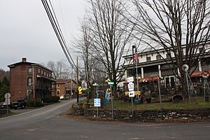
Point Pleasant, Pennsylvania facts for kids
Quick facts for kids
Point Pleasant, Pennsylvania
|
|
|---|---|
|
Unincorporated community
|
|

Point Pleasant Historic District
|
|
| Country | United States |
| State | Pennsylvania |
| County | Bucks |
| Township | Plumstead and Tinicum |
| Elevation | 98 ft (30 m) |
| Time zone | UTC-5 (Eastern (EST)) |
| • Summer (DST) | UTC-4 (EDT) |
| ZIP code |
18950
|
| Area code(s) | 215, 267 and 445 |
| GNIS feature ID | 1204432 |
Point Pleasant is a small community in Pennsylvania, United States. It's special because it sits right where the Tohickon Creek meets the big Delaware River. This community is split between two townships, Tinicum and Plumstead. The creek acts as the natural border between them. If you ever send mail here, the ZIP code is 18950!
Contents
A Look at Point Pleasant's Past
Point Pleasant has a long and interesting history. Long ago, the Lenape Native American people lived here. They often fished in the Delaware River, which was a very important resource for them.
Early Settlements and Mills
Because of its location near the river, Point Pleasant became a good place for grist mills. These mills used the power of the flowing water to grind grain into flour. During the American Revolutionary War, these mills were very important. They ground grain to feed the soldiers fighting for America's freedom.
A Stop for Travelers
In later years, Point Pleasant became a popular resting spot. It was a place where canalmen could take a break. These were people who worked on the Delaware Division of the Pennsylvania Canal. The canal was like a water highway used to transport goods. Point Pleasant was also a waystation for stagecoaches traveling between Doylestown, Frenchtown, and New York. A waystation was a place where travelers could rest, change horses, and get fresh supplies.
Historic Places to See
Several important places in Point Pleasant are listed on the National Register of Historic Places. This is a special list of buildings, sites, and objects that are important in American history. Some of these include:
- Bridge in Tinicum Township
- Cabin Run Covered Bridge
- Frankenfield Covered Bridge
- Point Pleasant Historic District
The Point Pleasant Water Pump
Point Pleasant is home to a very important water pump. This large pump has been working since 1989. It takes water from the Delaware River and sends it to other places.
Supplying Drinking Water
The water pumped from Point Pleasant helps fill the Bradshaw Reservoir and Lake Galena Reservoir. This water is then cleaned and used as drinking water for people in Montgomery County and Bucks County. The water is also pumped into the North Branch Neshaminy Creek.
Who Uses the Water?
Many different groups and companies use the water that comes from this pump. Some of the biggest users include:
- PECO Energy Company
- North Wales Water Authority
- North Penn Water Authority
Getting Around Point Pleasant
Point Pleasant is easy to reach because of its location. It sits right along the Delaware River, which was historically a major transportation route.
Main Roads and Connections
Today, Pennsylvania Route 32 runs through Point Pleasant. This road connects the community to other towns. For example, if you head south on Route 32, you can easily get to New Hope.
 | William L. Dawson |
 | W. E. B. Du Bois |
 | Harry Belafonte |


