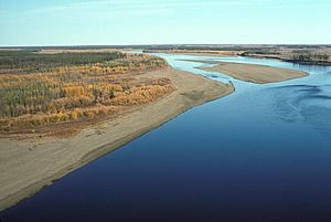
Porcupine River facts for kids
Quick facts for kids Porcupine River |
|
|---|---|

Porcupine River
|
|
|
Location of the mouth of the Porcupine River in Alaska
|
|
| Native name | Ch’ôonjik |
| Countries |
|
| Territories/States | |
| Physical characteristics | |
| Main source | Nahoni Range Ogilvie Mountains, Yukon, Canada 65°28′N 139°32′W / 65.467°N 139.533°W |
| River mouth | Yukon River Fort Yukon, Alaska, United States 126 m (413 ft) 66°35′42″N 145°18′32″W / 66.59500°N 145.30889°W |
| Length | 916 km (569 mi) |
| Depth |
|
| Basin features | |
| Basin size | 118,000 km2 (46,000 sq mi) |
The Porcupine River is a long river that flows through parts of Canada and the United States. It is about 916 kilometers (569 miles) long. This river is a major branch, or tributary, of the larger Yukon River. Its name comes from the Gwich’in language, where Ch’ôonjik means "Porcupine Quill River."
The Porcupine River starts in the Ogilvie Mountains in Yukon, Canada. It flows north through a community called Old Crow. Then, it turns southwest and enters the U.S. state of Alaska. Finally, it joins the Yukon River near Fort Yukon, Alaska.
Contents
Wildlife and Ancient Discoveries
Home to Caribou Herds
The river gives its name to the famous Porcupine caribou herd. These caribou are a type of reindeer. They use the areas around the Porcupine River for giving birth to their young. This important area is part of the Arctic National Wildlife Refuge (ANWR) in Alaska.
Ancient Discoveries
Scientists have found very old animal bones near the Porcupine River. These bones were found in the Bluefish Caves. They might show signs of being changed by early humans. Radiocarbon dating suggests these bones could be 25,000 to 40,000 years old. This is much earlier than when people were generally thought to have first lived in North America.
Boating Adventures
The Porcupine River is a great place for a river trip. It is good for people who are new to boating but have experience in remote wilderness. You can travel by canoe, kayak, or raft. However, rafters might find it hard to paddle against strong winds going upriver.
A long trip of about 500 miles (800 km) can start at Summit Lake in the Yukon. You would go down the Bell River until it meets the Porcupine River. Then, you continue all the way to Fort Yukon. This entire trip is usually considered easy, or Class I, on the international scale of river difficulty. But if the water is high, some parts might become a bit harder, like Class II. This can happen in the Upper and Lower Rampart canyons, which are downstream from the border.
See also
 In Spanish: Río Porcupine (Alaska) para niños
 | James Van Der Zee |
 | Alma Thomas |
 | Ellis Wilson |
 | Margaret Taylor-Burroughs |


