Ogilvie Mountains facts for kids
Quick facts for kids Ogilvie Mountains |
|
|---|---|

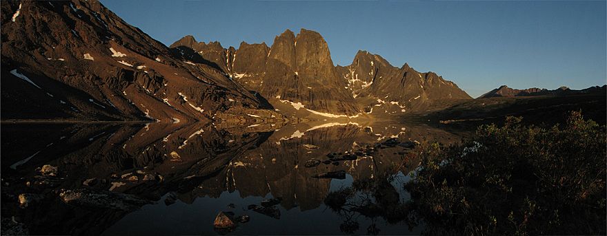
Mountains in Tombstone Territorial Park
|
|
| Highest point | |
| Peak | Mount Frank Rae |
| Elevation | 2,362 m (7,749 ft) |
| Geography | |
| Country | Canada |
| Territories | Yukon |
| Range coordinates | 64°22′N 137°16′W / 64.367°N 137.267°W |
| Parent range | Yukon Ranges |
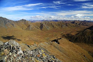
The Ogilvie Mountains are a cool mountain range found in the Yukon Territory. This territory is in the northwestern part of Canada. These mountains are part of a bigger group called the Yukon Ranges. They are also part of the North American Cordillera, which is a huge chain of mountains across North America.
Where Are the Ogilvie Mountains?
This mountain range is located north of Dawson City. A famous road, the Dempster Highway, actually crosses right through these mountains.
The area was first explored by a surveyor named William Ogilvie. A surveyor is someone who measures and maps land. The mountains were later named after him to honor his work.
Smaller Mountain Groups
The Ogilvie Mountains include some smaller mountain groups within them. One of these is the:
- Nahoni Range
Famous Peaks
Some of the most well-known mountain peaks in the Ogilvie Mountains are found inside Tombstone Territorial Park. This park is famous for its amazing scenery.
The tallest mountain in the Ogilvie range is Mount Frank Rae. It stands at a height of 2,362 meters (7,749 feet) above sea level.
The most recognizable mountains in this range have sharp, jagged peaks made of granite. These include:
- Tombstone Mountain
- Mount Monolith
 | Lonnie Johnson |
 | Granville Woods |
 | Lewis Howard Latimer |
 | James West |


