Potaro River facts for kids
Quick facts for kids Potaro River |
|
|---|---|

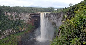
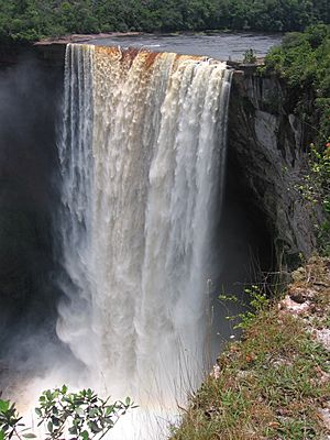
Kaieteur Falls in Potaro River.
|
|
| Country | Guyana |
| Province | Potaro-Siparuni |
| Physical characteristics | |
| Main source | Mount Ayanganna 6,690 ft (2,040 m) |
| River mouth | Essequibo River |
| Length | 255 km (158 mi) |
| Basin features | |
| Basin size | 9,800 km2 (3,800 sq mi) |
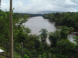
The Potaro River is an important river in Guyana. It starts in the Pakaraima Mountains near Mount Ayanganna. The river flows for about 255 kilometers (158 miles) before joining the Essequibo River, which is Guyana's biggest river. The famous Kaieteur Falls is located on the Potaro River.
Contents
What Makes the Potaro River Special?
The Potaro River is home to nine amazing waterfalls. The most famous ones are Kaieteur Falls and Tumatumari Falls. Below Kaieteur Falls, you can find Amatuk Falls and Waratuk Falls.
A long Suspension bridge called the Garraway Stream Bridge crosses the river. It was built way back in 1930. You can also find a spot called 'Two Islands' on the Potaro River.
What Minerals Are Found Here?
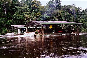
The area around the Potaro River is rich in minerals. People find both gold and diamonds here. Thousands of ounces of gold have been found in the river's gravel and soil.
In the early 1900s, small-scale miners called pork-knockers found many high-quality diamonds. The two largest diamonds ever found in Guyana came from this area. One was 56.75 carats (11.35 grams) from the Little Uewang River. The other was 25.67 carats (5.134 grams) from Maple Creek.
Sometimes, people try to mine illegally, which is against the law. It's hard to stop them because the area is very remote.
A special mineral called Potarite was first found in this river. It was named after the Potaro River by Sir John B. Harrison.
Communities Along the River
Several villages are located along the Potaro River. These include Micobie, Tumatumari, and Chenapau (which is south of Kaieteur Falls).
Menzies Landing is a short walk upstream from Kaieteur Falls. It's a main starting point for people traveling further up the river. Beyond the falls, the Potaro Plateau stretches out towards the Pakaraima Mountains.
In the mid-1950s, the first power plant was built at Tumatumari Falls. It used the river's water to create electricity. This power helped run the machines used for gold mining. However, the plant closed down after a long workers' strike. Later, in 1976, the Guyana National Service used one of the plant's turbines to power their offices until 1987.
Potaro Landing: A Travel Hub
The Potaro River can be traveled by boat up to a place called Potaro Landing. Further upstream, there are many fast-moving rapids and waterfalls. These make it impossible for boats to go any further.
In 1933, the Denham Suspension Bridge opened near Potaro Landing. This bridge made it easier to reach the gold mining areas deeper inside the country. There used to be a daily boat service from Tumatumari Landing to Potaro Landing. This service carried people and goods to the interior.
In 2012, about 112 people lived in Potaro Landing and the surrounding area. Potaro Landing is located at 5°21′23″N 59°07′07″W / 5.3565°N 59.1185°W.
See also
 In Spanish: Río Potaro para niños
 | Percy Lavon Julian |
 | Katherine Johnson |
 | George Washington Carver |
 | Annie Easley |


