Pouto Peninsula facts for kids
Quick facts for kids Pouto Peninsula |
|
|---|---|
| Poutō Peninsula | |

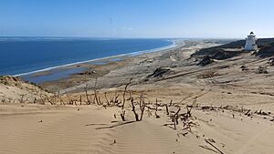
Pouto North Head and Lighthouse looking looking west out through the Kaipara Harbour mouth
|
|
| Location | Kaipara District |
| Coordinates | 36°15′S 174°2′E / 36.250°S 174.033°E |
| Geology | Peninsula |
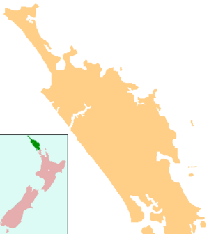
The Pouto Peninsula is a long piece of land in Northland, New Zealand. It's located on the northern side of the Kaipara Harbour. This peninsula stretches for about 55 kilometers (34 miles). Its width changes, from about 5.4 km (3.4 miles) to 14 km (8.7 miles) at its widest point.
To the west of the peninsula is the Tasman Sea. The Kaipara Harbour is to the south and east. The Wairoa River also runs along its eastern side. The town of Dargaville is just to the northeast. A smaller piece of land, the Te Korowai-o-Te-Tonga Peninsula, is across the harbour mouth to the south.
The main town on the peninsula is Te Kōpuru. The area called Pouto, which used to be a Māori village, is in the southeast.
Geography and Nature
A big part of the Pouto Peninsula, over 600 hectares, is covered in sand dunes. These are some of the largest natural sand dune systems in New Zealand. Many of these dunes are over 100 meters (328 feet) high. The tallest one reaches 214 meters (702 feet) above sea level.
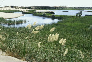
The peninsula also has many wet areas, like permanent and temporary wetlands. There are more than 20 freshwater lakes and swamps. The middle part of the peninsula has forests with trees that are not native to New Zealand.
Many special plants and animals live here. This includes several types of plants, birds, insects, and a freshwater fish that are considered threatened. This means they are at risk of disappearing if not protected.
Shipwrecks and Stories
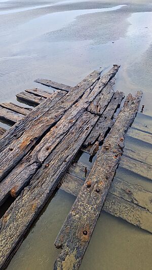
The entrance to the Kaipara Harbour, near the Pouto Peninsula, can be very dangerous for ships. The land here is low, and there aren't many clear landmarks to help sailors find their way. Because of this, 113 shipwrecks have been recorded around Kaipara North Head.
An old Māori story tells of Rongomai, the captain of the Mahuhu canoe. He drowned when his canoe overturned near the harbour entrance a long time ago. The first shipwreck that was officially recorded happened in 1840. This was the Aurora, a large sailing ship. The most recent shipwreck was the fishing boat Francie in 2016.
A New Zealand filmmaker named Winston Cowie looked into stories about possible old Portuguese or Spanish shipwrecks on the Pouto Peninsula. He talked to local elders who had oral traditions about a Spanish ship, helmets, armor in the sand, and even buried treasure. He believes more research is needed to confirm if these stories are true.
History of Pouto
People have lived on the Pouto Peninsula for a very long time. Descendants of the Māhuhu canoe crew settled here, possibly around the 1200s. Later, in the 1300s, some people from the Aotea canoe might have joined them.
In the 1400s, a chief named Taramainuku, whose grandfather was the captain of the Arawa canoe, settled near North Head. He took over the area from the people living there before. The wider Kaipara area is said to be named after a special feast, called a hāngī, that Taramainuku held. At this feast, a fern called para was served. In the Māori language, "Kai" means "food."
Around the late 1600s or early 1700s, the Ngāti Whātua tribe moved south and took over the Pouto Peninsula. In 1820, during the Musket Wars, the Ngā Puhi tribe attacked Ngāti Whātua's Tauhara pa (a fortified village) near Pouto. They couldn't capture it, so they agreed to a truce. However, during the celebration, Ngā Puhi and their friends suddenly attacked and killed many of the Ngāti Whātua people.
In 1874, a customs house and a pilot station were built at Pouto. These helped guide ships safely into the harbour. A signal mast was put up in the sandhills in 1876, and a telegraph system connected it to the station the next year. A lighthouse was built at North Head in 1884 to warn ships. The customs office moved to Te Kōpuru in 1903. The lighthouse started working automatically in 1947 and closed in the mid-1950s. The building is still there and was fixed up in the 1980s.
From the 1870s to the 1930s, people called Gum-diggers worked on the peninsula. They dug up kauri gum, even though kauri trees no longer grew there. Dairy farming also started in the early 1900s. Sand from Pouto was used to build dams in the Waitākere Ranges and was also moved by boat around the Kaipara Harbour.
The southern part of the peninsula was slow to develop. The road only reached Taingaehe in 1930 and extended to Pouto itself in 1931. Before that, people mostly traveled by steamer (a type of boat). The road wasn't properly paved until the 1940s.
Education
Pouto School is a school for children from years 1 to 8. It has 10 students as of February 2024. . The first school in Pouto was started in 1878.
There is also a primary school in Te Kōpuru. A local historian, Logan Forrest, wrote a leaflet in 1985 about the history of education on the Pouto Peninsula. It covered the Pouto, Waikare, Punahaere, and Rangitane schools up to 1984.
Climate
| Climate data for Pouto (1980–1987) | |||||||||||||
|---|---|---|---|---|---|---|---|---|---|---|---|---|---|
| Month | Jan | Feb | Mar | Apr | May | Jun | Jul | Aug | Sep | Oct | Nov | Dec | Year |
| Mean daily maximum °C (°F) | 22.9 (73.2) |
22.7 (72.9) |
21.9 (71.4) |
19.6 (67.3) |
17.0 (62.6) |
15.3 (59.5) |
14.3 (57.7) |
14.5 (58.1) |
15.7 (60.3) |
17.0 (62.6) |
19.1 (66.4) |
21.3 (70.3) |
18.4 (65.2) |
| Daily mean °C (°F) | 19.4 (66.9) |
19.4 (66.9) |
18.6 (65.5) |
16.4 (61.5) |
14.0 (57.2) |
12.4 (54.3) |
11.3 (52.3) |
11.5 (52.7) |
12.7 (54.9) |
13.9 (57.0) |
15.8 (60.4) |
17.8 (64.0) |
15.3 (59.5) |
| Mean daily minimum °C (°F) | 15.8 (60.4) |
16.0 (60.8) |
15.4 (59.7) |
13.3 (55.9) |
11.0 (51.8) |
9.6 (49.3) |
8.3 (46.9) |
8.5 (47.3) |
9.7 (49.5) |
10.8 (51.4) |
12.5 (54.5) |
14.3 (57.7) |
12.1 (53.8) |
| Average rainfall mm (inches) | 92.8 (3.65) |
85.3 (3.36) |
119.1 (4.69) |
123.6 (4.87) |
108.8 (4.28) |
100.8 (3.97) |
111.3 (4.38) |
117.9 (4.64) |
101.8 (4.01) |
83.7 (3.30) |
52.1 (2.05) |
85.1 (3.35) |
1,182.3 (46.55) |
| Source: NIWA (rainfall 1981–2010) | |||||||||||||
See also
 In Spanish: Península de Pouto para niños
 | Bessie Coleman |
 | Spann Watson |
 | Jill E. Brown |
 | Sherman W. White |


