Pritchett, Colorado facts for kids
Quick facts for kids
Pritchett, Colorado
|
|
|---|---|

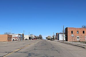
Looking north along Randolph Street (2019)
|
|

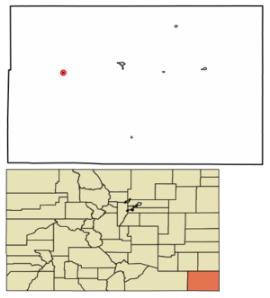
Location within Baca County and Colorado
|
|
| Country | United States |
| State | Colorado |
| County | Baca |
| Incorporated | 1923 |
| Government | |
| • Type | Statutory Town |
| Area | |
| • Total | 0.23 sq mi (0.60 km2) |
| • Land | 0.23 sq mi (0.60 km2) |
| • Water | 0.00 sq mi (0.00 km2) |
| Elevation | 4,826 ft (1,471 m) |
| Population
(2020)
|
|
| • Total | 112 |
| • Density | 487/sq mi (186.7/km2) |
| Time zone | UTC−7 (MST) |
| • Summer (DST) | UTC−6 (MDT) |
| ZIP Code |
81064
|
| Area code | 719 |
| FIPS code | 08-61315 |
| GNIS ID | 2412509 |
Pritchett is a small town in Baca County, Colorado, United States. It is known as a statutory town, which means it follows certain rules set by the state of Colorado. In 2020, about 112 people lived there.
History of Pritchett
Pritchett got its name from Henry S. Pritchett, who was an important person involved with the railroad. A post office opened in Pritchett in 1927. This was an important step for the community, helping people send and receive mail. The town officially became an incorporated place in 1923.
Geography of Pritchett
Pritchett is located in the western part of Baca County. A main road, U.S. Route 160, goes right through the town. If you travel east on this road for about 16 miles, you will reach Springfield, which is the county seat. The county seat is like the main town or capital of a county. If you go west on the same road, you can travel about 106 miles to reach Trinidad.
The town of Pritchett is quite small. It covers an area of about 0.2 square miles (0.6 square kilometers). All of this area is land, meaning there are no lakes or large rivers within the town limits.
Population Changes in Pritchett
The number of people living in Pritchett has changed over the years. Here is a look at the population from different U.S. Decennial Census counts:
| Historical population | |||
|---|---|---|---|
| Census | Pop. | %± | |
| 1930 | 451 | — | |
| 1940 | 495 | 9.8% | |
| 1950 | 286 | −42.2% | |
| 1960 | 247 | −13.6% | |
| 1970 | 170 | −31.2% | |
| 1980 | 183 | 7.6% | |
| 1990 | 153 | −16.4% | |
| 2000 | 137 | −10.5% | |
| 2010 | 140 | 2.2% | |
| 2020 | 112 | −20.0% | |
| U.S. Decennial Census | |||
As you can see, the population was highest in 1940 with 495 people. Since then, it has slowly decreased. In 2020, the population was 112 people.
See also
 In Spanish: Pritchett para niños
 | Janet Taylor Pickett |
 | Synthia Saint James |
 | Howardena Pindell |
 | Faith Ringgold |

