
Proctorville, Ohio facts for kids
Quick facts for kids
Proctorville, Ohio
|
|
|---|---|
|
Village
|
|

Proctorville's municipal water tower, built in 2003
|
|

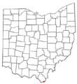
Location of Proctorville, Ohio
|
|

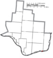
Location of Proctorville in Lawrence County
|
|
| Country | United States |
| State | Ohio |
| County | Lawrence |
| Township | Union |
| Area | |
| • Total | 0.27 sq mi (0.70 km2) |
| • Land | 0.24 sq mi (0.62 km2) |
| • Water | 0.03 sq mi (0.09 km2) |
| Elevation | 551 ft (168 m) |
| Population
(2020)
|
|
| • Total | 523 |
| • Density | 2,197.48/sq mi (848.83/km2) |
| Time zone | UTC-5 (Eastern (EST)) |
| • Summer (DST) | UTC-4 (EDT) |
| ZIP code |
45669
|
| Area code(s) | 740 |
| FIPS code | 39-64766 |
| GNIS feature ID | 2399026 |
Proctorville is a small village located in Lawrence County, Ohio, United States. It sits right along the Ohio River. In 2020, about 523 people lived there.
A bridge called the East End Bridge connects Proctorville to Huntington, West Virginia. This bridge goes right over the Ohio River. Proctorville is also part of a larger area called the Huntington-Ashland Metropolitan Statistical Area. This means it's connected to nearby cities in West Virginia and Kentucky.
Contents
History of Proctorville
Early Settlement and Naming
The land where Proctorville is today was first settled way back in 1797. It was known as Quaker Bottom then. Because it was on the Ohio River, Quaker Bottom became an important place for trading in the 1800s.
In 1834, a man named Jacob Proctor opened a general store near the river's edge. River boat captains started calling the village "Proctor's Landing." Later, in 1878, the village officially became a town and was named Proctorville to honor Jacob Proctor.
The Rome Beauty Apple
Did you know a famous apple comes from near Proctorville? The Rome Beauty apple was first grown by Joel Gillette and his son Alanson in 1816. This happened in Rome Township, which is very close to Proctorville.
Challenges and Growth
Proctorville has faced some tough times. On April 7, 1900, a big fire destroyed many businesses in the village. Most of these businesses were never rebuilt. The village also suffered from major floods in 1913 and 1937, which caused a lot of damage.
However, Proctorville has grown since the East End Bridge was finished in 1985. This bridge made it easier to travel between Proctorville and Huntington. In 2024, a strong storm called a derecho caused damage to the area.
Geography of Proctorville
Proctorville covers a total area of about 0.27 square miles (0.70 square kilometers). Most of this area is land, with a small part being water. The village is located along the Ohio River, between the towns of Athalia and Chesapeake.
Population and People
How Many People Live Here?
The number of people living in Proctorville has changed over the years. Here's how the population has grown and shrunk:
| Historical population | |||
|---|---|---|---|
| Census | Pop. | %± | |
| 1880 | 385 | — | |
| 1890 | 480 | 24.7% | |
| 1900 | 523 | 9.0% | |
| 1910 | 577 | 10.3% | |
| 1920 | 629 | 9.0% | |
| 1930 | 675 | 7.3% | |
| 1940 | 731 | 8.3% | |
| 1950 | 737 | 0.8% | |
| 1960 | 831 | 12.8% | |
| 1970 | 881 | 6.0% | |
| 1980 | 975 | 10.7% | |
| 1990 | 765 | −21.5% | |
| 2000 | 620 | −19.0% | |
| 2010 | 574 | −7.4% | |
| 2020 | 523 | −8.9% | |
| U.S. Decennial Census | |||
A Look at the Community
In 2010, there were 574 people living in Proctorville. There were 251 households, which are groups of people living together. About 150 of these were families. The average age of people in the village was about 40 years old.
- About 21% of residents were under 18 years old.
- About 25% were between 25 and 44 years old.
- About 18% were 65 years or older.
The village had a mix of people, with most being White. A small number of people were African American, Native American, or from other backgrounds. About 1% of the population was Hispanic or Latino.
Community and Learning
Public Library

Proctorville has its own public library. It is a part of the Briggs Lawrence County Public Library system. Libraries are great places to read, learn, and find information!
Local Schools
In 1949, Proctorville High School joined with Rome Township's school to create the Fairland Local School District. They chose the name "Fairland" because the school is located near the old Lawrence County Fairgrounds.
The Fairland school district has several schools for different age groups:
- Fairland East (for grades K-2)
- Fairland West (for grades 3-5)
- Fairland Middle School (for grades 6-8)
- Fairland High School (for grades 9-12)
In the 2022-2023 school year, over 1,400 students were enrolled in the Fairland Local School District.
Images for kids
-

Proctorville's municipal water tower, built in 2003
-
Location of Proctorville, Ohio
-
Location of Proctorville in Lawrence County
See also
 In Spanish: Proctorville (Ohio) para niños
