Puerto Morelos facts for kids
Quick facts for kids
Puerto Morelos
|
|
|---|---|

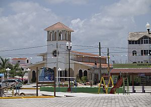
Puerto Morelos plaza
|
|
| Lua error in Module:Location_map at line 416: Malformed coordinates value. | |
| Country | |
| State | |
| Municipality | Puerto Morelos |
| Named for | José María Morelos |
| Elevation | 4 m (13 ft) |
| Population
(2020)
|
|
| • Total | 19,202 |
| Demonym(s) | Puertomorelense |
| Time zone | UTC-5 (Eastern Standard Time) |
| Postal Code |
77580
|
| Area code(s) | 998 |
Puerto Morelos is a town, port, and a local government area (municipality) in Mexico. It is located in the state of Quintana Roo, on the Yucatán Peninsula. The town is about 36 kilometers (22 miles) south of Cancún and 30 kilometers (19 miles) north of Playa del Carmen.
On December 6, 2015, Puerto Morelos joined with the village of Leona Vicario. Together, they became the 11th municipality in Quintana Roo. Before this, Puerto Morelos was part of the Benito Juarez municipality.
Contents
History of Puerto Morelos
For a long time, Puerto Morelos was the main port connecting the Yucatán mainland to Cozumel Island. A car ferry used to travel between Puerto Morelos and Cozumel. The town is named after José María Morelos, an important leader in Mexico's fight for independence.
Many resorts can be found in the Puerto Morelos area, along the Riviera Maya. There are also growing numbers of attractions. These include the Crococun Crocodile Zoo, the Botanical Garden, and many cenotes (natural sinkholes filled with water). Recently, smaller inns have opened, offering evening programs about local history and marine life.
Just 100 meters (about 328 feet) from the shore is the Puerto Morelos part of the Mesoamerican Barrier Reef System. This area was made a National Marine Park in 1998. This happened thanks to local people who worked to protect the environment.
Geography of Puerto Morelos
Puerto Morelos is split into three parts by a highway and a mangrove swamp. The area west of the highway is called "Colonia Joaquin Zetina Gazca". The part east of the highway is known as "Colonia Pescadores".
The section on the coast, east of the mangrove swamp, is called "Puerto" or "Antiguo (old) Puerto Morelos". This was the original fishing village. Today, it is a calm neighborhood with homes, hotels, restaurants, and shops for tourists.
The second part of the town is about 2 kilometers (1.2 miles) inland, next to Highway 307. This inland area mainly has single-story homes for local workers. In recent years, new housing has been built, including apartment buildings. There are also private areas between the highway and the mangrove where people can buy land and build their own houses.
Climate in Puerto Morelos
Puerto Morelos has a tropical wet and dry climate. This means it is warm all year round. Even in the driest month, the average temperature is above 18°C (64°F).
| Climate data for Puerto Morelos (1951–2010) | |||||||||||||
|---|---|---|---|---|---|---|---|---|---|---|---|---|---|
| Month | Jan | Feb | Mar | Apr | May | Jun | Jul | Aug | Sep | Oct | Nov | Dec | Year |
| Record high °C (°F) | 34.5 (94.1) |
36.5 (97.7) |
38.0 (100.4) |
39.5 (103.1) |
41.5 (106.7) |
40.5 (104.9) |
39.0 (102.2) |
41.0 (105.8) |
41.0 (105.8) |
39.0 (102.2) |
38.0 (100.4) |
35.0 (95.0) |
41.5 (106.7) |
| Mean daily maximum °C (°F) | 28.2 (82.8) |
28.6 (83.5) |
29.7 (85.5) |
31.2 (88.2) |
32.3 (90.1) |
32.4 (90.3) |
33.0 (91.4) |
33.3 (91.9) |
32.3 (90.1) |
31.2 (88.2) |
29.7 (85.5) |
28.4 (83.1) |
30.9 (87.6) |
| Daily mean °C (°F) | 23.3 (73.9) |
23.4 (74.1) |
24.8 (76.6) |
26.7 (80.1) |
27.8 (82.0) |
28.1 (82.6) |
28.4 (83.1) |
28.3 (82.9) |
27.8 (82.0) |
26.6 (79.9) |
25.0 (77.0) |
23.7 (74.7) |
26.2 (79.2) |
| Mean daily minimum °C (°F) | 18.4 (65.1) |
18.2 (64.8) |
20.0 (68.0) |
22.2 (72.0) |
23.3 (73.9) |
23.7 (74.7) |
23.8 (74.8) |
23.3 (73.9) |
23.3 (73.9) |
21.9 (71.4) |
20.4 (68.7) |
19.0 (66.2) |
21.5 (70.7) |
| Record low °C (°F) | 5.0 (41.0) |
6.0 (42.8) |
8.0 (46.4) |
9.0 (48.2) |
12.0 (53.6) |
12.0 (53.6) |
17.0 (62.6) |
12.0 (53.6) |
17.0 (62.6) |
12.0 (53.6) |
10.0 (50.0) |
9.0 (48.2) |
5.0 (41.0) |
| Average rainfall mm (inches) | 78.6 (3.09) |
45.2 (1.78) |
42.3 (1.67) |
54.0 (2.13) |
102.0 (4.02) |
138.3 (5.44) |
90.3 (3.56) |
126.7 (4.99) |
187.1 (7.37) |
184.0 (7.24) |
98.8 (3.89) |
74.7 (2.94) |
1,222 (48.11) |
| Average rainy days (≥ 0.1 mm) | 6.4 | 3.9 | 3.1 | 3.2 | 5.4 | 8.9 | 7.8 | 9.8 | 12.9 | 11.8 | 8.7 | 7.0 | 88.9 |
| Source: Servicio Meteorologico Nacional | |||||||||||||
Population Growth
Puerto Morelos has grown quickly because of tourism. In 2010, the town was home to 9,188 people.
| Population of Puerto Morelos | ||
|---|---|---|
| Year | Pop. | ±% p.a. |
| 1980 | 672 | — |
| 1990 | 740 | +0.97% |
| 1995 | 829 | +2.30% |
| 2000 | 892 | +1.48% |
| 2005 | 1,097 | +4.22% |
| 2010 | 9,188 | +52.97% |
Transportation and Port
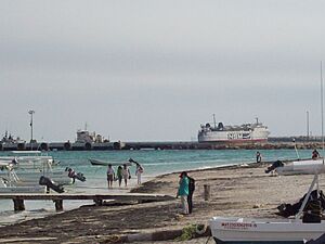
The marine terminal at Puerto Morelos is a very important seaport for the state of Quintana Roo. It is set up to handle large containers of goods. In 2019, the port handled 41.2 thousand metric tons of cargo.
A new train station for the Tren Maya opened near Puerto Morelos on March 15, 2024.
| Preceding station | Following station | |||
|---|---|---|---|---|
| Playa del Carmen
toward Felipe Carrillo Puerto
|
Tren Maya | Cancún Airport
Terminus
|
||
Images for kids
See also
 In Spanish: Puerto Morelos para niños
 | Isaac Myers |
 | D. Hamilton Jackson |
 | A. Philip Randolph |


