Purranque facts for kids
Quick facts for kids
Purranque
|
||||
|---|---|---|---|---|
 |
||||
|
||||
| Country | Chile | |||
| Region | Los Lagos | |||
| Province | Osorno | |||
| Villa Lo Burgos de Purranquil | April 18, 1911 | |||
| Founded by | Tomás Burgos | |||
| Government | ||||
| • Type | Municipality | |||
| Area | ||||
| • Total | 1,458.8 km2 (563.2 sq mi) | |||
| Population
(2002 Census)
|
||||
| • Total | 20,705 | |||
| • Density | 14.1932/km2 (36.7601/sq mi) | |||
| • Urban | 13,265 | |||
| • Rural | 7,440 | |||
| Sex | ||||
| • Men | 10,354 | |||
| • Women | 10,351 | |||
| Time zone | UTC−4 (CLT) | |||
| • Summer (DST) | UTC−3 (CLST) | |||
| Area code(s) | 56 + 64 | |||
| Climate | Cfb | |||
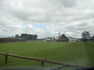
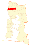
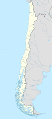
Purranque is a city in Chile, located in the Los Lagos Region. It is about 65 kilometers (40 miles) north of Puerto Montt. The city is part of the Osorno Province and sits along the Pan-American Highway.
Contents
History of Purranque
The first people to live in this area were the Huilliches. They are an indigenous group. The land belonged to a chief named Raylef. He was known as "Cacique Don Raylef de Purranquil." In the Mapudungun language, "Purranquil" means "bush land."
The city we know today was started on April 18, 1911. It was first called "Villa Lo Burgos de Purranquil." Tomás Burgos founded it on a piece of land. This land was about 45 kilometers (28 miles) south of Osorno. It was also along the railroad line that connected Osorno to Puerto Montt. On November 24, 1941, Purranque officially became a city by law.
Geography and Climate
Purranque's Climate
Purranque has an oceanic climate, also known as Cfb in the Köppen climate classification. This means it has mild temperatures. In summer, the temperature can reach up to 23°C (73°F). Winters in Purranque are cold, with temperatures dropping to about 4°C (39°F). It is common to see frost during the winter months.
Travel and Transportation
If you want to visit Purranque, you can fly into nearby airports. The Canal Bajo Carlos Hott Siebert Airport is close to Osorno. The El Tepual International Airport is near Puerto Montt.
Population and Area
According to the 2002 census by the National Statistics Institute, Purranque covers an area of 1,458.8 square kilometers (563.2 square miles). At that time, 20,705 people lived there. This included 10,354 men and 10,351 women.
Most of the people, 13,265 (64.1%), lived in urban areas (cities and towns). The remaining 7,440 people (35.9%) lived in rural areas (the countryside). Between 1992 and 2002, the population of Purranque grew by 2.6%. This means 529 more people moved there.
How Purranque is Governed
Purranque is a commune, which is a local government area in Chile. It is managed by a municipal council. The council is led by an alcalde, who is like a mayor. The alcalde is chosen directly by the people every four years. From 2008 to 2012, the alcalde was César Negrón Schwerter, from the Socialist Party.
Education in Purranque
In the past, Purranque had a German school called Deutsche Schule Purranque.
See also
 In Spanish: Purranque para niños
 | Ernest Everett Just |
 | Mary Jackson |
 | Emmett Chappelle |
 | Marie Maynard Daly |


