Putre facts for kids
Quick facts for kids
Putre
|
||||||
|---|---|---|---|---|---|---|
|
Town and Commune
|
||||||

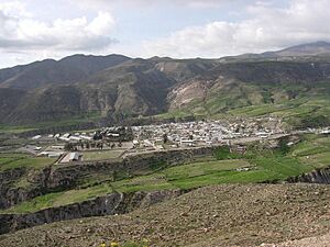
Panoramic view of Putre
|
||||||
|
||||||
| Country | ||||||
| Region | ||||||
| Province | Parinacota | |||||
| Founded | 1580 | |||||
| Seat | Putre | |||||
| Government | ||||||
| • Type | Municipal council | |||||
| Area | ||||||
| • Town and Commune | 5,902.5 km2 (2,279.0 sq mi) | |||||
| Elevation | 3,371 m (11,060 ft) | |||||
| Population
(2012 Census)
|
||||||
| • Town and Commune | 1,366 | |||||
| • Density | 0.23143/km2 (0.59939/sq mi) | |||||
| • Urban | 1,235 | |||||
| • Rural | 742 | |||||
| Demonym(s) | Putreño / a | |||||
| Sex | ||||||
| • Male | 1,345 | |||||
| • Female | 632 | |||||
| Time zone | UTC-4 (CLT) | |||||
| • Summer (DST) | UTC-3 (CLST) | |||||
| Area code(s) | 56 + 58 | |||||
| Climate | ET | |||||
| Website | Official website: http://www.imputre.cl/ | |||||
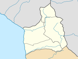
Putre is a small but important Chilean town. It is also a "commune," which is like a local government area. Putre is the capital of the Parinacota Province in the Arica-Parinacota Region.
This town is located about 130 kilometers (80 miles) east of Arica. It sits very high up, at an altitude of about 3,500 meters (11,480 feet) above sea level. The amazing Taapaca volcanic complex forms a beautiful backdrop to the town.
Putre is right on the edge of the Lauca National Park. Many visitors come here to explore the park. They often stay in Putre first to get used to the high altitude. There is also a historic church in the town.
The Putre commune includes several smaller villages. These include Socoroma, Tignamar, Belén, Chapiquiña, Pachama, Ancuta, Guallatiri, Parinacota, Chucuyo, and Caquena.
In 2011, a moderate earthquake happened near Putre. It was 6.2 magnitude, but luckily, it caused no injuries and only minor damage.
What's the Weather Like in Putre?
Putre has a special kind of weather called an alpine tundra climate. This means it's usually cold, especially at night, and can have some snow. It's also close to a cold semi-arid climate, which means it doesn't get a lot of rain.
| Climate data for Putre (1976–2009) | |||||||||||||
|---|---|---|---|---|---|---|---|---|---|---|---|---|---|
| Month | Jan | Feb | Mar | Apr | May | Jun | Jul | Aug | Sep | Oct | Nov | Dec | Year |
| Mean daily maximum °C (°F) | 14.5 (58.1) |
14.8 (58.6) |
15.1 (59.2) |
16.1 (61.0) |
15.6 (60.1) |
14.8 (58.6) |
14.2 (57.6) |
15.2 (59.4) |
15.7 (60.3) |
16.1 (61.0) |
15.9 (60.6) |
15.4 (59.7) |
15.3 (59.5) |
| Daily mean °C (°F) | 9.2 (48.6) |
9.4 (48.9) |
9.8 (49.6) |
9.1 (48.4) |
8.1 (46.6) |
7.5 (45.5) |
8.6 (47.5) |
8.9 (48.0) |
9.3 (48.7) |
9.3 (48.7) |
9.5 (49.1) |
9.3 (48.7) |
9.0 (48.2) |
| Mean daily minimum °C (°F) | 3.9 (39.0) |
3.9 (39.0) |
3.7 (38.7) |
3.5 (38.3) |
2.5 (36.5) |
1.4 (34.5) |
0.7 (33.3) |
1.9 (35.4) |
2.2 (36.0) |
2.5 (36.5) |
3.1 (37.6) |
3.2 (37.8) |
2.7 (36.9) |
| Average precipitation mm (inches) | 155 (6.1) |
97 (3.8) |
28 (1.1) |
1 (0.0) |
1 (0.0) |
1 (0.0) |
1 (0.0) |
2 (0.1) |
2 (0.1) |
2 (0.1) |
18 (0.7) |
68 (2.7) |
376 (14.8) |
| Source: Atlas Agroclimatico de Chile | |||||||||||||
Who Lives in Putre?
The word "demographics" tells us about the people living in a place. In 2002, a study counted 1,977 people living in Putre. Most of them (1,235 people) lived in the town itself, which is considered an urban area. The rest (742 people) lived in rural areas, like the smaller villages.
Between 1992 and 2002, the population of Putre actually decreased by about 826 people.
How Putre is Governed
Putre is a "commune," which means it has its own local government. This government is run by a municipal council. The leader of the council is called the alcalde (mayor), and people vote for them every four years.
Putre is part of a larger area for elections. When people vote for members of the Chamber of Deputies (which is like one part of the country's parliament), Putre is in the 1st electoral district. It is also part of the 1st senatorial constituency for the Senate. These are the groups that help make laws for Chile.
See also

- In Spanish: Putre para niños
 | Audre Lorde |
 | John Berry Meachum |
 | Ferdinand Lee Barnett |


