
Río Abajo, Vega Baja, Puerto Rico facts for kids
Quick facts for kids
Río Abajo
|
|
|---|---|
|
Barrio
|
|

Puerto Rico Highway 22 in Río Abajo
|
|

Location of Río Abajo within the municipality of Vega Baja shown in red
|
|

Río Abajo, Vega Baja, Puerto Rico
Location in Caribbean
|
|
| Commonwealth | |
| Municipality | |
| Area | |
| • Total | 2.40 sq mi (6.2 km2) |
| • Land | 2.36 sq mi (6.1 km2) |
| • Water | 0.04 sq mi (0.1 km2) |
| Elevation | 39 ft (12 m) |
| Population
(2010)
|
|
| • Total | 4,795 |
| • Density | 2,031.80/sq mi (784.48/km2) |
| Source: 2010 Census | |
| Time zone | UTC−4 (AST) |
Río Abajo is a neighborhood, or "barrio," located in Vega Baja, a town in Puerto Rico. In 2010, about 4,795 people lived there.
A Look at Río Abajo's History
After the Spanish–American War ended in 1898, Spain gave Puerto Rico to the United States. This happened because of a special agreement called the Treaty of Paris of 1898. Puerto Rico then became a territory of the U.S.
A year later, in 1899, the U.S. government counted all the people living in Puerto Rico. This count is called a census. They found that Río Abajo and its neighboring area, Río Arriba, had a total of 1,092 people living there together.
| Historical population | |||
|---|---|---|---|
| Census | Pop. | %± | |
| 1960 | 3,603 | — | |
| 1980 | 4,512 | — | |
| 1990 | 5,656 | 25.4% | |
| 2000 | 5,620 | −0.6% | |
| 2010 | 4,795 | −14.7% | |
| U.S. Decennial Census 1899 (shown as 1900) 1910-1930 1930-1950 1960 1980-2000 2010 |
|||
Pictures of Río Abajo
-
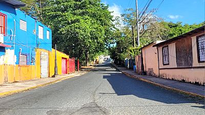
Puerto Rico Highway 674 in Río Abajo

See also
- List of communities in Puerto Rico
- In Spanish: Río Abajo (Vega Baja) para niños

All content from Kiddle encyclopedia articles (including the article images and facts) can be freely used under Attribution-ShareAlike license, unless stated otherwise. Cite this article:
Río Abajo, Vega Baja, Puerto Rico Facts for Kids. Kiddle Encyclopedia.