Río Muni facts for kids
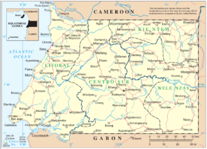
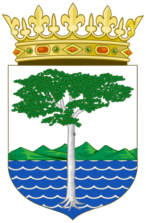
Río Muni is a big part of a country called Equatorial Guinea. It's the main land area, not counting the islands. People sometimes call it the Continental Region. In the local Fang language, it's known as Mbini.
This area covers about 26,017 square kilometers (10,045 square miles). Río Muni got its name from the Muni River. Long ago, early European explorers built settlements along this river.
A Look at History
Río Muni was given to Spain by Portugal in 1778. This happened because of a special agreement called the Treaty of El Pardo. Spain hoped to find people there to work in their other lands.
However, many of the Spanish settlers got sick with yellow fever and sadly died. Because of this, the area was left empty for a while. Later, people came back, and growing cocoa and cutting timber became very important jobs. In 1959, Río Muni joined with an island called Bioko to become a province of Spanish Guinea.
Who Lives There?
In 2015, about 885,015 people lived in Río Muni. This was about 72% of all the people in Equatorial Guinea.
The main languages spoken here are different types of Fang. Fang-Ntumu is spoken in the northern parts. Fang-Okak is spoken more in the south. People also speak Spanish, but usually as a second language.
Provinces of Río Muni
Río Muni is divided into five smaller areas called provinces:
Main Cities
The biggest city in Río Muni is Bata. It's also the main city where the government for the region is located.
Other important towns include:
See also
 In Spanish: Región Continental (Guinea Ecuatorial) para niños
- Elobey, Annobón and Corisco
- Popular Idea of Equatorial Guinea
- Postage stamps and postal history of Equatorial Guinea
 | Georgia Louise Harris Brown |
 | Julian Abele |
 | Norma Merrick Sklarek |
 | William Sidney Pittman |


