Rabbit Ears (Clayton, New Mexico) facts for kids
|
Rabbit Ears
|
|

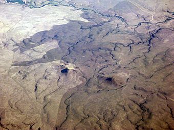
Oblique air photo facing north in August 2011
|
|
| Nearest city | Clayton, New Mexico |
|---|---|
| Area | 15,250 acres (61.7 km2) |
| NRHP reference No. | 66000499 |
Quick facts for kids Significant dates |
|
| Added to NRHP | October 15, 1966 |
| Designated NHLD | May 23, 1963 |
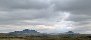
The Rabbit Ears are two mountain peaks in northeastern New Mexico, United States. They are about 8 kilometers (5 miles) north of the city of Clayton, New Mexico. These two peaks were a very important landmark. They helped travelers find their way along the Santa Fe Trail, especially the Cimarron Cutoff. This trail was a major path for people moving west in the 1800s. Because of their historical importance, the Rabbit Ears were named a National Historic Landmark in 1963.
The taller of the two peaks is about 1,848 meters (6,063 feet) high. It stands hundreds of feet above the flat lands around it, which are part of the Great Plains.
What Are the Rabbit Ears?
The Rabbit Ears are part of a group of hills and mountains called the Clayton Complex. This area is north of Clayton and near the border between New Mexico and Colorado. The two main peaks are called Rabbit Ears Mountain and Mount Clayton. Mount Clayton was also known as the Round Mound in the past.
Rabbit Ears Mountain has two peaks. It is located directly north of Clayton. New Mexico State Road 370 runs along its south and west sides. Mount Clayton is to the west of Rabbit Ears Mountain. It is south of where United States Route 85 and New Mexico State Road 453 meet. The Clayton Complex is part of a larger area of old volcanoes called the Raton-Clayton volcanic field. The Rabbit Ears are the only part of this field that you can see from Texas.
The Santa Fe Trail Connection
The Cimarron Cutoff was one of two main paths of the Santa Fe Trail. This trail was a very important route in the 1800s. It connected Kansas City, Missouri to Santa Fe, New Mexico. The Cimarron Cutoff started near Fort Dodge. It generally followed the Cimarron River into what is now northeastern New Mexico. From there, it went southwest towards Santa Fe. Today, parts of U.S. Route 56 and United States Route 412 follow a similar path to the eastern part of the Cimarron Cutoff.
The Rabbit Ears were a key landmark for travelers. They could be seen from more than 30 miles (48 kilometers) away. This was very helpful in the wide-open landscape. They were also important because they showed where travelers could find water. Water was often hard to find in this area.
Because of the water, three places near the mountains became popular campsites for travelers. These were:
- McNees Crossing on Corrumpa (or McNees) Creek
- Turkey Creek Camp on what is now called Alamos Creek
- Rabbit Ears Camp on Cienequilla Creek
These creeks usually had water in the spring. Even when they didn't flow strongly, they still provided water. Camps were set up along their banks. The exact spot depended on how much water was available. You can still see old wagon ruts from the trail in these areas today.
The Rabbit Ears formation is also mentioned in the book Mustang Man by Louis L'Amour.
 | Emma Amos |
 | Edward Mitchell Bannister |
 | Larry D. Alexander |
 | Ernie Barnes |


