Rail Road Flat, California facts for kids
Quick facts for kids
Rail Road Flat
|
|
|---|---|

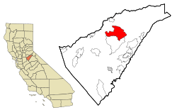
Location in Calaveras County and the state of California
|
|
| Country | |
| State | |
| County | Calaveras |
| Area | |
| • Total | 33.162 sq mi (85.889 km2) |
| • Land | 33.006 sq mi (85.486 km2) |
| • Water | 0.156 sq mi (0.403 km2) 0.47% |
| Elevation | 2,608 ft (795 m) |
| Population
(2020)
|
|
| • Total | 316 |
| • Density | 9.529/sq mi (3.679/km2) |
| Time zone | UTC-8 (Pacific (PST)) |
| • Summer (DST) | UTC-7 (PDT) |
| ZIP code |
95248
|
| Area code(s) | 209 |
| FIPS code | 06-59220 |
| GNIS feature IDs | 255013, 2409122 |
| Reference #: | 286 |
Rail Road Flat is a small community in Calaveras County, California, United States. It's known as a census-designated place (CDP), which means it's an area identified by the census bureau for statistical purposes. In 2020, about 316 people lived here. The town was once called Independence Flat and Railroad Flat.
Contents
Exploring the History of Rail Road Flat
This historic town is located about 2,600 feet (788 meters) above sea level. It got its unique name from the simple, mule-drawn carts used by miners long ago. These carts were used to move ore, even though there was never a real railroad in the area!
The town was founded in 1849, during the exciting time of the California Gold Rush. It was an important spot for mining, especially for finding gold in both placer (loose gold in streams) and quartz (gold found in rock) deposits. One of the biggest mines here was called the Petticoat Mine.
Rail Road Flat was also a significant place for local Native American tribes, serving as a site for an important council meeting. The town established its first post office in 1857. It closed for a short time but reopened in 1869. The Edwin Taylor store, a local landmark, was built in 1867.
A man named W.V. Clark helped the mining efforts by building the Clark Reservoir. He created a ditch from the Mokelumne River to bring much-needed water to the mines and the town. This was very important because there wasn't enough natural water for mining.
Today, Rail Road Flat is recognized as California Historical Landmark #286. This means it's an important place in California's history.
Geography and Location
Rail Road Flat covers a total area of about 33.2 square miles (85.9 square kilometers). Most of this area, about 33.0 square miles (85.5 square kilometers), is land. A small part, about 0.2 square miles (0.4 square kilometers), is water. This water makes up about 0.47% of the total area.
Population and Community Life
Let's look at who lives in Rail Road Flat. In 2010, the population was 475 people. This means there were about 14 people living in each square mile.
Most of the people living in Rail Road Flat were White. There were also Native American, Asian, and Pacific Islander residents. Some people identified with two or more races. About 8.6% of the population identified as Hispanic or Latino.
There were 220 homes in Rail Road Flat. About 18.6% of these homes had children under 18 living in them. Many homes were families, including married couples. The average number of people living in each home was about 2.16.
The community has a mix of ages. In 2010, about 16.2% of the people were under 18 years old. About 25.7% were 65 years or older. The average age of residents was around 53.7 years. Most homes were owned by the people living in them, with about 76.8% being owner-occupied.
In 2000, the population was 549 people. The average household size was 2.29 people. The median income for a household was $35,938. This means half the households earned more than this, and half earned less. About 18.4% of the population lived below the poverty line.
See also
 In Spanish: Rail Road Flat para niños


