Mokelumne River facts for kids
Quick facts for kids Mokelumne River |
|
|---|---|
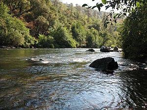
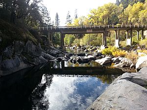
The Mokelumne River near the State Highway 49 bridge above Pardee Reservoir
|
|
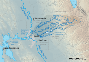
Map of the Mokelumne River watershed
|
|
| Country | United States |
| State | California |
| Physical characteristics | |
| Main source | Confluence of North and Middle Forks Sierra Nevada, Amador/Calaveras Counties 916 ft (279 m) 38°22′20″N 120°36′38″W / 38.37222°N 120.61056°W |
| River mouth | Sacramento-San Joaquin Delta Walnut Grove, San Joaquin County 0 ft (0 m) 38°05′46″N 121°34′12″W / 38.09611°N 121.57000°W |
| Length | 95 mi (153 km) |
| Basin features | |
| Basin size | 2,143 sq mi (5,550 km2) |
The Mokelumne River is a 95-mile (153 km) long river in northern California. It starts in the rugged Sierra Nevada mountains. The river then flows west into the Central Valley. Finally, it reaches the Sacramento–San Joaquin River Delta, where it joins the San Joaquin River.
The Mokelumne River and its main branch, the Cosumnes River, drain a huge area. This area covers 2,143 square miles (5,550 km²) across five California counties. If you measure from its farthest source, the river is about 157 miles (253 km) long.
People often talk about the Upper Mokelumne River. This part goes from where the river begins to Pardee Reservoir. The Lower Mokelumne River is the part below Camanche Dam. The lower river is very important for watering farms. It also supplies water to the eastern San Francisco Bay Area through the Mokelumne Aqueduct.
The name "Mokelumne" comes from the Plains Miwok language. Moke means "fishnet," and -umne means "people of." The town of Mokelumne Hill was named after the river around 1850.
Contents
- River's Journey: Where the Mokelumne Flows
- Mokelumne River's Surroundings: The Watershed
- River's Past: A Look at Mokelumne History
- Fun on the River: Recreational Uses
- River's Changes: How People Use the Mokelumne
- River Life: Mokelumne Ecology
- Protecting the River: Conservation and Restoration
- River Branches: Tributaries
River's Journey: Where the Mokelumne Flows
The Mokelumne River starts when several smaller streams join together. These streams begin high up in the central Sierra Nevada mountains. The longest branch is the North Fork, which is 62 miles (100 km) long. It starts at Highland Lakes, which is 8,584 feet (2,616 m) high.
The North Fork flows into Salt Springs Reservoir. Below this, it meets the Bear River. It then passes through Tiger Creek Reservoir before joining the Middle Fork. The Middle Fork is 28 miles (45 km) long. It starts near Ganns and flows west.
The South Fork is 26 miles (42 km) long. It flows west, parallel to the Middle Fork, and joins it before the Middle Fork meets the North Fork.
Main River Path
The main Mokelumne River begins where the North and Middle Forks meet. It flows west-southwest towards Pardee Reservoir. This reservoir is held back by the 345-foot (105 m) high Pardee Dam. Right below Pardee, the river flows into Camanche Reservoir, created by Camanche Dam.
The river forms the border between Amador and Calaveras counties for a long stretch. Below Camanche Dam, it enters San Joaquin County. The Camanche Dam is the first barrier that fish cannot pass.
Lower River and Delta
Below Camanche Dam, the Mokelumne winds for 34 miles (55 km). It flows past Lockeford and then turns northwest at Lodi. Here, a small dam called Woodbridge Dam creates Lodi Lake. The river then gets water from Dry Creek and its biggest branch, the Cosumnes River.
The river then flows west and south into the Sacramento–San Joaquin River Delta. Here, the river becomes tidal, meaning its water level changes with the ocean tides. It splits into two branches, the North and South Mokelumne River. These branches go around Staten Island. After about 7 miles (11 km), the branches rejoin. A few miles later, the Mokelumne flows into the San Joaquin River.
Mokelumne River's Surroundings: The Watershed
The Mokelumne River watershed is the entire area of land that drains into the river. It covers 2,143 square miles (5,550 km²). This area includes parts of Alpine, Amador, Calaveras, San Joaquin, and Sacramento Counties. The land ranges from sea level at the river's end to 10,400 feet (3,170 m) high in the Sierra Nevada.
The upper part of the watershed is mostly wilderness. Much of it is protected within the 105,165-acre (42,559 ha) Mokelumne Wilderness. There are also private lands, including forests and areas managed by the East Bay Municipal Utility District. This district takes water from Pardee Reservoir for cities.
The lower part of the watershed is in the Central Valley. This area is rich farmland. Grapes are the main crop grown here. Vineyards make up more than half of the basin's farmland. Other uses include raising animals, orchards, and growing yearly crops.
River's Past: A Look at Mokelumne History
The Mokelumne River basin was originally home to Native American people. These included the Yokuts, Miwok, and Wintun tribes. The lower river area was very populated, with many villages. The Plains Miwok people lived here. They called the river Wakalumitch, which might mean "big river."
Spanish explorers likely visited the river in the late 1700s or early 1800s. The name "Mokelumne" was first written down by a Spanish missionary in 1817. The modern spelling was set around 1844. In the Yokuts language, "Mokelumne" is thought to mean "Condor River."
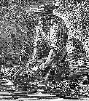
During the California Gold Rush, the Mokelumne was a very important place for finding gold. Gold was first found here in 1848. By 1850, Mokelumne Hill grew into a busy town with 15,000 people. Much of the gold trade from the Mokelumne River went through the city of Stockton.
Fun on the River: Recreational Uses
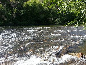
The Mokelumne River is a great place for outdoor activities. It has five popular spots for whitewater kayaking. These include exciting runs like Fantasy Falls and Devil's Nose. The Electra-Middle Bar run is a bit calmer, good for Class II-III kayaking.
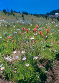
The river is also a favorite spot for fishing, camping, and playing in the water. People enjoy birdwatching, picnics, and looking for gold. In spring, you can see beautiful wildflowers. Electra Road is a popular place for walking and enjoying the river.
Near Salt Springs Reservoir, there are large granite domes like Calaveras Dome. These are popular for rock climbing. There are also three campgrounds nearby: Mokelumne River, White Azalea, and Moore Creek.
For those who love true wilderness, the Mokelumne Wilderness offers challenging backpacking. Downstream, the river is also popular. The area near Camanche Dam has a day-use park and the Mokelumne River Fish Hatchery. Lodi Lake in Lodi is another popular city park.
River's Changes: How People Use the Mokelumne
People started changing the Mokelumne River in the mid-1850s. They diverted water for gold mining during the California Gold Rush. Later, in 1875, the first irrigation project began to water farms.
In 1929, the East Bay Municipal Utility District (EBMUD) built Pardee Dam. This large dam is the main place where water is stored and taken from the river. The water travels through the 91-mile (146 km) long Mokelumne Aqueduct. This aqueduct provides water to 35 towns in the eastern San Francisco Bay Area. Water first reached the Bay Area on June 23, 1929. Pardee Dam also helps keep the lower Mokelumne River's water level steady for farming.
Since the late 1800s, the Mokelumne has also been used to make hydroelectric power. Pacific Gas and Electric (PG&E) built several dams for this purpose. Salt Springs Dam was completed in 1931 on the North Fork. The project can produce 206 megawatts of electricity.
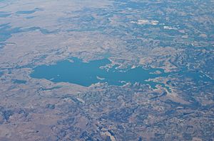
In 1963, Camanche Dam was built just below Pardee Dam. Its main job is to control floods for towns downstream. This allows more water to be stored in Pardee Reservoir for the Bay Area. Camanche Dam is the largest reservoir on the Mokelumne. It also helps regulate water for local farms.
The Mokelumne River in the Delta is part of a bigger water system. This system moves water from the Sacramento River to central and southern California. The Delta Cross Channel connects the Sacramento River to the Mokelumne. This helps large pumps move water south across the Delta.
River Life: Mokelumne Ecology
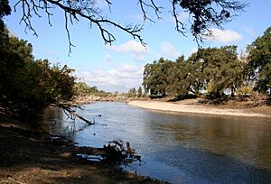
The Mokelumne River is home to Pacific salmon and steelhead trout. These fish swim upstream to lay their eggs. Historically, they could go past where Pardee Dam is now. To make up for lost habitat after Camanche Dam was built, the Mokelumne River Fish Hatchery was built in 1964.
The Lower Mokelumne River has at least 35 kinds of fish. Besides salmon and trout, you can find native fish like prickly sculpin and Sacramento sucker. Non-native fish like western mosquitofish, largemouth bass, and bluegill are also common.
The Cosumnes River, a major branch of the Mokelumne, is special because it doesn't have large dams. However, water diversions for farming have still caused problems for fish migration there.
Protecting the River: Conservation and Restoration
In 1999, different groups worked together to protect the Mokelumne. They signed an agreement for PG&E's hydroelectric project. This agreement helps the river flow more naturally. It also led to removing or taking apart three small dams on smaller streams. This improved places for recreation and set up a plan to watch the river's health.
About 37 miles (60 km) of the Mokelumne River are considered special. They are eligible for National Wild and Scenic River status. This means they are protected for their natural beauty and value. In 2014, a bill was introduced to make part of the river a California Wild and Scenic River.
This bill faced some challenges but eventually passed. In 2015, a new bill was signed into law. It asked for a study of the Mokelumne River's suitability for Wild and Scenic status. This bill also gave the river temporary protections.
In 2018, the study was finished. It recommended adding about 37 miles (60 km) of the North Fork and main Mokelumne to the California Wild and Scenic Rivers System. This recommendation became law on June 27, 2018. The Mokelumne became the 15th river in this special system.
Since 2014, groups have been working to help salmon and steelhead trout return to areas above Camanche and Pardee reservoirs. This work is still ongoing.
River Branches: Tributaries
- Dry Creek
- Cosumnes River
- Bear River
- Blue Creek
- Beaver Creek
- Green Creek
- Camp Creek
- Ashland Creek
 | Madam C. J. Walker |
 | Janet Emerson Bashen |
 | Annie Turnbo Malone |
 | Maggie L. Walker |


