
Amador County, California facts for kids
Quick facts for kids
Amador County, California
|
|||
|---|---|---|---|

The Amador County foothills in April 2007
|
|||
|
|||
| Nickname(s):
"The Heart of the Mother Lode"
|
|||

Location in the state of California
|
|||
| Country | United States | ||
| State | California | ||
| Region | Sierra Nevada | ||
| Incorporated | May 1, 1854 | ||
| Named for | José María Amador | ||
| County seat | Jackson | ||
| Largest city | Ione (population and area) | ||
| Government | |||
| • Type | Council–CAO | ||
| • Body |
Board of Supervisors
Pat Crew
Richard M. Forster Jeff Brown Frank Axe Brian Oneto |
||
| Area | |||
| • Total | 606 sq mi (1,570 km2) | ||
| • Land | 595 sq mi (1,540 km2) | ||
| • Water | 11.4 sq mi (30 km2) | ||
| Highest elevation | 9,414 ft (2,869 m) | ||
| Population
(2020)
|
|||
| • Total | 40,474 | ||
| • Estimate
(2023)
|
41,811 |
||
| • Density | 66.79/sq mi (25.787/km2) | ||
| GDP | |||
| • Total | $1.921 billion (2022) | ||
| Time zone | UTC-8 (Pacific Time Zone) | ||
| • Summer (DST) | UTC-7 (Pacific Daylight Time) | ||
| Area code | 209 | ||
| FIPS code | 06-005 | ||
| GNIS feature ID | 1675841 | ||
| Congressional district | 5th | ||


Amador County is a county in the state of California, USA. It is located in the Sierra Nevada mountains. In 2020, about 40,474 people lived there. The main city and county seat is Jackson.
Amador County is part of California's Gold Country. It is known as "The Heart of the Mother Lode" because of its rich history with gold mining. The county also has a big wine-making industry.
Contents
History of Amador County
.jpg)

Amador County was created on May 11, 1854. It was formed from parts of Calaveras and El Dorado counties. A small part of its land was later given to Alpine County in 1864.
The county is named after José María Amador. He was a soldier, rancher, and miner. He was born in San Francisco in 1794. In 1848, José María Amador and some Native Americans found gold. They set up a successful gold mining camp near what is now Amador City. The word amador means "one who loves" in Spanish.
Some of the most successful gold mines in the Mother Lode were in Amador County. These included the Kennedy, Argonaut, and Keystone mines. The Kennedy Mine in Jackson was the deepest gold mine of its time. The government closed these mines in 1942. This happened during World War II because mining was not seen as important for the war effort.
Geography of Amador County
Amador County covers about 606 square miles (1,570 square kilometers). Most of this area, about 595 square miles (1,540 square kilometers), is land. The rest, about 11.4 square miles (29.5 square kilometers), is water. It is one of the smallest counties in California.
Rivers and Lakes
Many water bodies are found in Amador County. These include Lake Amador, Lake Camanche, and Pardee Reservoir. Other important water spots are Bear River Reservoir, Silver Lake, and Lake Tabeaud. The Sutter Creek, Cosumnes River, and Mokelumne River also flow through the county. In 2018, part of the Mokelumne River became a California Wild and Scenic River.
Location and Elevation
Amador County is about 45 miles (72 kilometers) southeast of Sacramento. It is in the area known as the Mother Lode or Gold Country. This region is in the Sierra Nevada mountains.
The county's elevation changes a lot. It ranges from about 250 feet (76 meters) in the west. It goes up to over 9,000 feet (2,700 meters) in the east. The highest point is Thunder Mountain. The Cosumnes River and El Dorado County are to the north. The Mokelumne River and Calaveras County are to the south. Sacramento and San Joaquin Counties are to the west. Alpine County is to the east.
Neighboring Counties
- El Dorado County – north
- Alpine County – east
- Calaveras County – south
- San Joaquin County – southwest
- Sacramento County – west
Protected Natural Areas
- Eldorado National Forest (part)
- Mokelumne Wilderness (part)
Population in Amador County
The population of Amador County has changed over time. In 1860, there were about 10,930 people. By 2020, the population grew to 40,474.
People and Backgrounds
In 2020, the people living in Amador County had different backgrounds.
- About 73.44% were White (not Hispanic or Latino).
- About 3.00% were Black or African American.
- About 1.43% were Native American.
- About 1.37% were Asian.
- About 14.86% were Hispanic or Latino (of any race).
Economy of Amador County

The Shenandoah Valley in Amador County is famous for its wine. It was once a very important wine region in California. When gold was discovered, many people came to the area. Wineries started to appear, and some of their vineyards are still used today.
The end of the California Gold Rush and the start of Prohibition hurt the wine industry. But today, the area has many wineries again. Amador County is known for its Zinfandel wine. Many other types of wine are also made here. Some Zinfandel vineyards in the county are over 125 years old. The original Grandpère vineyard, planted before 1869, is believed to have some of the oldest Zinfandel vines in America.
Education in Amador County
Amador County has one school district called Amador County Unified School District. Because there are not many people, the schools often have small class sizes.
There are two high schools, two junior high schools, and six elementary schools. The county also has two independent study schools, one charter school, and one adult education school. There are no colleges or universities in Amador County.
Transportation in Amador County
Main Roads
 State Route 16
 State Route 26
 State Route 49
 State Route 88
 State Route 104
 State Route 124
Public Transport
Amador Transit provides bus services in Jackson and nearby towns. You can connect to Calaveras County. There is also a daily bus for commuters to Sacramento. This bus leaves from the Sutter Hill Transit Center in Sutter Creek.
Airport
Amador County Airport is a small airport. It is used for general aviation and is located near Jackson.
Cities and Towns
Cities
- Amador City
- Ione
- Jackson (county seat)
- Plymouth
- Sutter Creek
Other Communities
- Amador Pines
- Buckhorn
- Buena Vista
- Camanche North Shore
- Camanche Village
- Carbondale
- Clinton
- Drytown
- Enterprise
- Fiddletown
- Kirkwood
- Lockwood
- Martell
- New Chicago
- Pine Acres
- Pine Grove
- Pioneer
- Red Corral
- River Pines
- Roaring Camp
- Sutter Hill
- Volcano
Images for kids
-
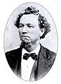
Dr. Charles Boarman (1828–1880) was the first county physician and coroner from 1863 to 1880.
-
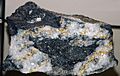
High-grade Gold-quartz ore from Amador County.
-

Company C, "Amador Volunteers" flag.

_(17161938811).jpg)

See also
 In Spanish: Condado de Amador para niños
