Rath Meave facts for kids
|
Ráth Medb
|
|

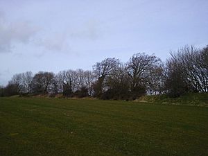
Edge of the enclosure
|
|
| Alternative name | Rath Meabe, Rath Maeve |
|---|---|
| Location | Odder/Belpere, County Meath, Ireland |
| Coordinates | 53°34′00″N 6°36′33″W / 53.566716°N 6.609074°W |
| Type | Embanked enclosure |
| Part of | Hill of Tara complex |
| Area | 3.978 hectares (9.83 acres) |
| Diameter | 230 metres (250 yd) |
| Circumference | 700 metres (770 yd) |
| History | |
| Material | earth |
| Founded | 2000–1500 BC |
| Periods | Early Bronze Age |
| Cultures | Atlantic Bronze Age |
| Designation | National Monument |
Rath Meave is an ancient circular earthwork, like a big round fence made of earth. It is found near the famous Hill of Tara in County Meath, Ireland. This special place is protected as a National Monument.
Where is Rath Meave Located?
Rath Meave sits in the Tara-Skryne Valley. It is about 1.3 kilometers (0.8 miles) south of the Hill of Tara. You can also find it about 3.4 kilometers (2.1 miles) east of Kilmessan.
What Does Rath Meave Look Like?
Rath Meave is mostly a circular henge, which is a type of ancient monument. It has a large bank of earth that forms a circle. This circle is about 700 meters (766 yards) long.
The area inside the henge covers about 4 hectares (10 acres). There is a break in the bank on the north side. This break was probably the entrance to the site. It lines up with the oldest part of Tara, called the Mound of the Hostages.
When Was Rath Meave Built?
Rath Meave was built a very long time ago, during the early Bronze Age. This was around 2000 to 1500 BC. It was built at the same time that the Mound of the Hostages was being used for burials.
The name Rath Meave comes from Medb Lethderg. She was a Celtic sovereignty goddess in Irish legend. People believed she was the wife or lover of nine different Kings of Tara. It is not clear if she is the same person as the more famous Medb from Cruachan. The Medb from Cruachan was a legendary Queen of Connacht.
 | William M. Jackson |
 | Juan E. Gilbert |
 | Neil deGrasse Tyson |


