Red Rock, Oklahoma facts for kids
Quick facts for kids
Red Rock, Oklahoma
Chína Ino Šúje
|
|
|---|---|

7 Clans Casino Sign, Red Rock, Oklahoma
|
|

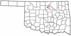
Location of Red Rock, Oklahoma
|
|
| Country | United States |
| State | Oklahoma |
| County | Noble |
| Area | |
| • Total | 0.25 sq mi (0.64 km2) |
| • Land | 0.25 sq mi (0.64 km2) |
| • Water | 0.00 sq mi (0.00 km2) |
| Elevation | 915 ft (279 m) |
| Population
(2020)
|
|
| • Total | 245 |
| • Density | 987.90/sq mi (381.20/km2) |
| Time zone | UTC-6 (Central (CST)) |
| • Summer (DST) | UTC-5 (CDT) |
| ZIP code |
74651
|
| Area code(s) | 580 |
| FIPS code | 40-62650 |
| GNIS feature ID | 2412538 |
Red Rock is a small town in northern Noble County, Oklahoma, United States. Its name in the Otoe-Missouria language is Chína Ino Šúje, which means "Rock Red town."
In 2020, about 245 people lived in Red Rock. The main office for the Otoe-Missouria Tribe of Indians is also located here.
Contents
History of Red Rock
Early Days and Name Change
In 1886, a railroad called the Atchison, Topeka and Santa Fe Railroad built tracks through the area that would become Noble County. At that time, the land near the Red Rock Creek railroad crossing was part of the Otoe-Missouria reservation.
A man named Rufus N. Dunagan ran a trading post there. In March 1890, a post office opened at the trading post and was named "Magnolia." The name was changed to Red Rock in June 1892.
The Dalton Gang Robbery
On June 1, 1892, a famous group of outlaws known as the Dalton Gang robbed a Santa Fe train in this area.
Powerful Tornadoes
On April 26, 1991, a very strong tornado touched down close to Red Rock. This tornado was rated F4 on the Fujita scale, which measures how strong tornadoes are. Even though it caused little damage, it had the highest recorded wind speed at the time: 270 miles per hour!
This record was later broken on May 3, 1999, by a tornado in Bridge Creek, Oklahoma. That tornado had wind gusts of 318 miles per hour.
Geography
Red Rock is a small town. According to the United States Census Bureau, the town covers an area of about 0.2 square miles (0.64 square kilometers). All of this area is land.
People of Red Rock
Population Changes Over Time
The number of people living in Red Rock has changed over the years. Here's how the population has looked during different census counts:
| Historical population | |||
|---|---|---|---|
| Census | Pop. | %± | |
| 1910 | 575 | — | |
| 1920 | 329 | −42.8% | |
| 1930 | 375 | 14.0% | |
| 1940 | 395 | 5.3% | |
| 1950 | 253 | −35.9% | |
| 1960 | 262 | 3.6% | |
| 1970 | 233 | −11.1% | |
| 1980 | 376 | 61.4% | |
| 1990 | 321 | −14.6% | |
| 2000 | 293 | −8.7% | |
| 2010 | 283 | −3.4% | |
| 2020 | 245 | −13.4% | |
| U.S. Decennial Census | |||
Who Lives in Red Rock?
In 2000, there were 293 people living in Red Rock. Most of the people living there were Native American (about 74%). About 20% were White, and about 6% were from two or more racial backgrounds. A small number, about 1%, were Hispanic or Latino.
There were 97 households in the town. A household is a group of people living together in one home. About 36% of these households had children under 18 living with them. The average household had about 3 people.
The town's population included people of all ages. About 33% were under 18, and 14% were 65 or older. The average age in Red Rock was 31 years old.
Education
In 1989, the Red Rock School District joined with the Marland district. The new, combined school district was named Frontier School District.
Sports
The sports teams for the Frontier School District are called the Frontier Mustangs. Their basketball teams have been very successful! They have gone to the state basketball tournament 14 times in a row. In the 20 years the school has existed, they have won six state championships.
Notable People
- Benjamin Arkeketa (1928-2002), a talented Navajo painter.
- Sanora Babb (1907-2005), an American novelist, poet, and editor.
- Della Warrior (born 1946), who grew up in Red Rock and became the first female leader of the Otoe-Missouria Tribe.
See also
 In Spanish: Red Rock (Oklahoma) para niños
 | Leon Lynch |
 | Milton P. Webster |
 | Ferdinand Smith |

