Redwood, Christchurch facts for kids
Quick facts for kids
Redwood
|
|
|---|---|
|
Suburb
|
|
|
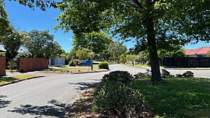
Redwood, Christchurch in early summer
|
|
| Country | New Zealand |
| Local authority | Christchurch |
| Electoral ward | Papanui |
| Area | |
| • Land | 332 ha (820 acre) |
| Population
(June 2023)
|
|
| • Total | 8,260 |
|
|
||
Redwood is a northern suburb of Christchurch, New Zealand. It includes the area known as Redwood Springs. The Styx River forms its northern border.
History of Redwood
Before European settlers arrived, Māori gathered food from the Styx River area. However, there were no lasting settlements here. The land was mostly swampy, covered in tall reeds called raupō.
The original forests had native trees like Tōtara and Kahikatea. Early settlers cleared the land and drained swamps to make farms.
In the late 1950s, farms started to be divided into smaller plots for houses. A row of shops opened near Prestons Road in 1957.
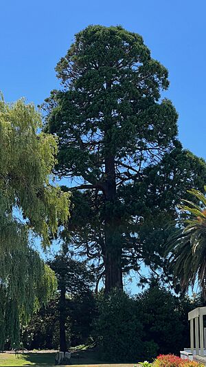
Redwood was first called Styx. But in the 1960s, local people voted to change the name. They chose from names like Caselwood, Clearview, Northpark, Redpark, and Redwood. The name comes from a huge redwood tree. It's still standing on Prestons Road today. Thomas Preston, an early settler, planted the tree in the late 1800s. Prestons Road is named after him.
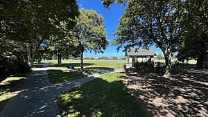
In 1960, the land for Redwood Park was bought. It was planned for a secondary school. By 1963, the high school plan was dropped. The land became Sturrocks Road Reserve. It was prepared for a sports ground and a kindergarten. In 1964, plans grew to include a community centre. By the end of that year, the sports field was leveled and grass was planted. A bonfire was lit on Guy Fawkes Night to raise money for the project. In 1965, an industrial park was built at Sturrocks and Cavendish roads. The reserve was renamed Redwood Park in 1967.
The Redwood Public Library opened on November 9, 1968. The building has eight sides and was designed by Len Wooding. The library also has a child care center. A public toilet and Plunket rooms were also built. The Plunket rooms are now used by a community group.
Redwood grew quickly in the 1970s. Many new housing areas changed it from a rural place to a true suburb. The Redwood scout hall was built between 1978 and 1980. In 1986, a rubbish transfer station opened on Styx Mill Road. Some people in the community did not like this station.
Redwood was part of Waimairi County. But in 1989, it became part of Christchurch City Council. This happened during the 1989 New Zealand local government reforms.
The suburb grew more in the 2000s. This included the Regent's Park area in the north-west. The Redwood Springs area also grew in the north-east. Redwood has its own community radio station, Classic Gold Radio Redwood 107.5FM.
Redwood's Population
Redwood covers about 3.32 square kilometers. It has an estimated population of 8260 people. This means there are about 2488 people per square kilometer.
At the 2018 New Zealand census, Redwood had 8,184 people. This was a small increase from 2013. There were 3,051 households. There were slightly more females than males. About 19.4% of people were under 15 years old.
Most people (83.4%) were European/Pākehā. About 11.9% were Māori. Other groups included Pasifika (3.2%) and Asian (9.2%). Some people identify with more than one group.
About 18.2% of people were born overseas. This is less than the national average of 27.1%.
When asked about religion, 51.5% said they had no religion. About 37.1% were Christian. Smaller numbers followed Hinduism, Islam, or Buddhism.
About 15.9% of people aged 15 or older had a university degree. About 21.8% had no formal qualifications. Most people were employed full-time (50.8%) or part-time (15.2%).
Getting Around Redwood
Main North Road is a big four-lane road. It runs through the middle of Redwood. This road connects Redwood to Christchurch Central City and other northern suburbs. These include Belfast and Kaiapoi. The Christchurch Northern Motorway runs east of Redwood. It lets traffic bypass the suburb. Environment Canterbury runs several bus services in Redwood. These include routes 1, 95, 107, and 125.
The Styx overbridge on Main North Road was built in the mid-1930s. A second bridge was added next to it in 2004. This made the road wider.
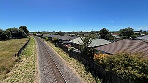
The Main North Railway goes through Redwood. Redwood was home to the Styx railway station. It was open for passengers from 1872 to 1977. The station was near the Styx overbridge, in the Redwood Springs area. The station finally closed completely in 1984.
Next to the railway tracks is the Christchurch Railway Cycleway. This bike path connects Redwood to the city center. The path also goes north through Redwood to Main North Road in Belfast.
Schools in Redwood
Redwood School and Northcote School are primary schools. They teach students from year 1 to year 6. Redwood School opened in 1969. Northcote School opened in 1960.
Papanui High School is the main public high school for the area. St. Bede's College is also in Redwood. It is a special-character integrated Catholic boys boarding school.
 | Charles R. Drew |
 | Benjamin Banneker |
 | Jane C. Wright |
 | Roger Arliner Young |


