Regan, North Dakota facts for kids
Quick facts for kids
Regan, North Dakota
|
|
|---|---|

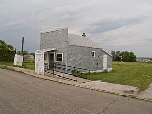
US Post office Regan
|
|

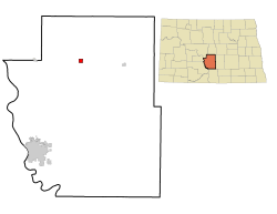
Location of Regan, North Dakota
|
|
| Country | United States |
| State | North Dakota |
| County | Burleigh |
| Founded | 1912 |
| Incorporated (village) | 1916 |
| Area | |
| • Total | 1.01 sq mi (2.63 km2) |
| • Land | 1.01 sq mi (2.63 km2) |
| • Water | 0.00 sq mi (0.00 km2) |
| Elevation | 2,031 ft (619 m) |
| Population
(2020)
|
|
| • Total | 35 |
| • Estimate
(2022)
|
34 |
| • Density | 34.52/sq mi (13.33/km2) |
| Time zone | UTC-6 (Central (CST)) |
| • Summer (DST) | UTC-5 (CDT) |
| ZIP code |
58477
|
| Area code(s) | 701 |
| FIPS code | 38-65980 |
| GNIS feature ID | 1036233 |
Regan is a small city located in Burleigh County, North Dakota, in the United States. In 2020, about 35 people lived there. The city was founded in 1912.
Contents
History of Regan
Regan was started in 1912. This happened after the Northern Pacific Railway built a train line through the area. The town was named after J. Austin Regan. He was a land company official who planned out the town in 1911.
In 1912, a post office and a church opened in Regan. A local newspaper, The Regan Headlight, began in 1913. The Regan School opened its doors in 1914. It was in a building that used to be a barbershop.
Early Regan had many useful businesses. These included two banks, a lumber yard, and a blacksmith shop. There was also a butcher shop and a hotel. A telephone company started in 1915. Regan officially became a village in 1916. An automobile garage opened in 1917, showing how the town was growing.
Geography and Climate
Regan's Location and Size
Regan is located in North Dakota. According to the United States Census Bureau, the city covers a total area of about 1.01 square miles (2.63 square kilometers). All of this area is land, with no water.
Understanding Regan's Climate
The weather in Regan changes a lot throughout the year. Summers are usually warm to hot, and sometimes humid. Winters are cold, and can be very cold. This type of weather is called a humid continental climate. On climate maps, it is often shown as "Dfb".
Population and People
| Historical population | |||
|---|---|---|---|
| Census | Pop. | %± | |
| 1920 | 202 | — | |
| 1930 | 162 | −19.8% | |
| 1940 | 149 | −8.0% | |
| 1950 | 129 | −13.4% | |
| 1960 | 104 | −19.4% | |
| 1970 | 74 | −28.8% | |
| 1980 | 71 | −4.1% | |
| 1990 | 51 | −28.2% | |
| 2000 | 43 | −15.7% | |
| 2010 | 43 | 0.0% | |
| 2020 | 35 | −18.6% | |
| 2022 (est.) | 34 | −20.9% | |
| U.S. Decennial Census 2020 Census |
|||
Regan is part of the larger Bismarck area. This area is sometimes called "Bismarck–Mandan".
Regan's Population in 2010
In 2010, the city of Regan had 43 people living in 23 households. There were 12 families among these households. The population density was about 42.6 people per square mile. Most of the people living in Regan were White (95.3%). A small number (4.7%) were from two or more racial backgrounds.
About 17.4% of households had children under 18 years old. More than half (52.2%) were married couples living together. About 43.5% of households had only one person. Some of these single-person households (13%) were people aged 65 or older. On average, each household had 1.87 people. Families had an average of 2.58 people.
The average age of people in Regan was 54.5 years. About 16.3% of residents were under 18. About 27.9% were aged 65 or older. The city had more males (58.1%) than females (41.9%).
Education in Regan
Students in Regan attend schools within the Wilton Public School District 1.
See also
 In Spanish: Regan (Dakota del Norte) para niños
 | Jackie Robinson |
 | Jack Johnson |
 | Althea Gibson |
 | Arthur Ashe |
 | Muhammad Ali |

