Richland, New York facts for kids
Quick facts for kids
Richland, New York
|
|
|---|---|

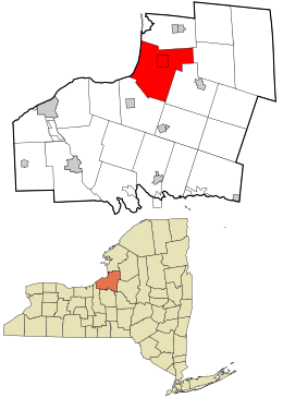
Location in Oswego County and the state of New York.
|
|
| Country | United States |
| State | New York |
| County | Oswego |
| Area | |
| • Total | 60.05 sq mi (155.53 km2) |
| • Land | 57.25 sq mi (148.27 km2) |
| • Water | 2.80 sq mi (7.25 km2) |
| Elevation | 387 ft (118 m) |
| Population
(2010)
|
|
| • Total | 5,718 |
| • Estimate
(2016)
|
5,606 |
| • Density | 97.92/sq mi (37.81/km2) |
| Time zone | UTC-5 (Eastern (EST)) |
| • Summer (DST) | UTC-4 (EDT) |
| ZIP code |
13144
|
| Area code(s) | 315 |
| FIPS code | 36-61533 |
| GNIS feature ID | 0979419 |
Richland is a small town located in the northeastern part of Oswego County, New York, United States. In 2010, about 5,718 people lived there.
Contents
History of Richland
Richland was first settled around the year 1801. The town itself was officially created in 1807. It was formed from a part of another town called Williamstown, New York.
Geography of Richland
Richland covers a total area of about 60.1 square miles (155.6 square kilometers). Most of this area, about 57.2 square miles (148.1 square kilometers), is land. The rest, about 2.9 square miles (7.5 square kilometers), is water.
The western edge of the town touches the large Lake Ontario.
Population and People
Richland has seen its population change over many years. Here is a look at how many people have lived in the town since 1820:
| Historical population | |||
|---|---|---|---|
| Census | Pop. | %± | |
| 1820 | 488 | — | |
| 1830 | 2,733 | 460.0% | |
| 1840 | 4,050 | 48.2% | |
| 1850 | 4,079 | 0.7% | |
| 1860 | 4,128 | 1.2% | |
| 1870 | 3,975 | −3.7% | |
| 1880 | 3,991 | 0.4% | |
| 1890 | 3,771 | −5.5% | |
| 1900 | 3,535 | −6.3% | |
| 1910 | 3,791 | 7.2% | |
| 1920 | 3,738 | −1.4% | |
| 1930 | 3,816 | 2.1% | |
| 1940 | 3,848 | 0.8% | |
| 1950 | 4,067 | 5.7% | |
| 1960 | 4,554 | 12.0% | |
| 1970 | 5,324 | 16.9% | |
| 1980 | 5,594 | 5.1% | |
| 1990 | 5,917 | 5.8% | |
| 2000 | 5,824 | −1.6% | |
| 2010 | 5,718 | −1.8% | |
| 2016 (est.) | 5,606 | −2.0% | |
| U.S. Decennial Census | |||
In 2000, there were 5,824 people living in Richland. There were 2,257 households, which are groups of people living together in one home. The average household had about 2.57 people.
The population included people of all ages. About 27.7% of the people were under 18 years old. The median age in the town was 36 years old. This means half the people were younger than 36, and half were older.
Communities and Places in Richland
Richland is home to several smaller communities and interesting spots:
- Bethel Corners – a small village on the north side of the Salmon River.
- Daysville – a small village in the southwest part of town.
- Daysville Corner – a spot on NY 3, south of Selkirk Shores State Park.
- Farmers Corner – a small village on US 11, south of Pulaski.
- Fernwood – a small village in the southern part of town.
- Malby Corners – a small village located north of Pulaski.
- Port Ontario – a small village on the south side of the Salmon River, along NY 3.
- Pulaski – a larger village within the town of Richland.
- Ramona Beach – a community right on the shore of Lake Ontario.
- Richland – the main village that shares the town's name, located in the eastern part of town.
- Selkirk – a small village on the shore of Lake Ontario, known for the Selkirk Light.
- Selkirk Shores State Park – a state park located on the shore of Lake Ontario, south of Selkirk. It's a great place for outdoor activities.
- Tinker Tavern Corner – a spot along US 11 in the southern part of town.
- Tylers Corner – a spot in the south-central part of town.
See also
 In Spanish: Richland (Nueva York) para niños
 | Selma Burke |
 | Pauline Powell Burns |
 | Frederick J. Brown |
 | Robert Blackburn |

