Rio de Flag facts for kids
Quick facts for kids Rio de Flag |
|
|---|---|
 |
|
| Physical characteristics | |
| Main source | Leroux Springs San Francisco Peaks, Arizona 8,000 feet (2,400 m) 35°17′36″N 111°43′29.6″W / 35.29333°N 111.724889°W |
| River mouth | San Francisco Wash Walnut Creek, Arizona 7,000 feet (2,100 m) 35°14′12.1″N 111°10′43.4″W / 35.236694°N 111.178722°W |
| Length | 33 miles (53 km) |
| Basin features | |
| Tributaries |
|
| Waterbodies | Frances Short Pond, Logan's Crossing |
| Waterfalls | Picture Canyon |
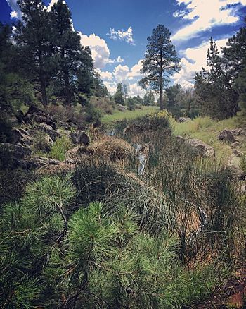
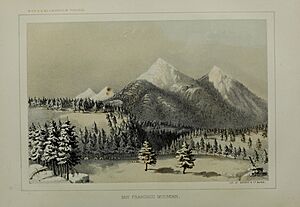
The Rio de Flag is a river in Arizona. It flows right through the city of Flagstaff. This river starts high up in the San Francisco Peaks and eventually flows into the Little Colorado River. Scientists believe the first channels of the river formed over a million years ago!
Contents
Where Does the Rio de Flag Start?
The Rio de Flag gets its water from several springs in the San Francisco Peaks. These springs don't always provide enough water on their own. But heavy rain and snowfall in the area help keep the river flowing.
Leroux Springs: The Main Source
The main starting points for the river are the Leroux Springs. These springs are located about 1.6 kilometers (1 mile) northwest of Flagstaff. Other springs, like Taylor Spring and Chimney Spring, also add water. A lot of the river's water also comes from melting snow on the south side of the mountains.
In 1857, a man named Edward Fitzgerald Beale visited Leroux Springs. He was planning a wagon road. He described the spring as having "transparent sparkling water." It flowed a short distance before disappearing into the valley.

History of Leroux Springs
The Leroux Springs are named after Antoine Leroux. He was a guide who led an expedition to the springs in 1851. During this trip, several new animal species were discovered near the springs. These included the Abert's squirrel and the Woodhouse's toad. Many people believe that the city of Flagstaff grew because of these springs. Beale's wagon road, which helped the city develop, passed right by them.
Over the years, the springs were changed to provide water for the city. Underground pipes reduced the natural flow of water. However, in 2013, a project began to help restore the springs to their natural flow.
How Does the Rio de Flag Flow?
The river flows from the mountains, generally following Route 180 towards Flagstaff.
River's Journey Through Flagstaff
- Cheshire Wetlands: Before reaching the main part of Flagstaff, the river flows through the Cheshire Wetlands. This area is near the Museum of Northern Arizona.
- Downtown Flagstaff: As the river turns southeast, Schultz Creek joins it. The Rio de Flag then continues south through downtown Flagstaff.
- Frances Short Pond: In the western part of the city, near Thorpe Park, the river forms the Frances Short Pond.
- Crossing Roads: The river crosses Route 66 and turns east. Sinclair Wash then flows into it. The river also crosses Interstate 40 (I-40) at Willow Bend, where you can find the I-40 Wetlands.
- Picture Canyon: The river then turns northeast towards East Flagstaff. It passes through Foxglenn Park before crossing back over I-40 and Route 66. Then it flows into Picture Canyon. Here, you can see a beautiful waterfall between narrow canyon walls.
- Logan's Crossing: Beyond Picture Canyon, the river crosses Townsend-Winona Road. It then follows the road's loop until it reaches Logan's Crossing. This area is a wetland and a bird sanctuary.
- San Francisco Wash: After Logan's Crossing, the river turns east-northeast towards the San Francisco Wash and the Little Colorado River. Much of the water in the river from Picture Canyon onwards comes from a nearby wastewater treatment plant.
The 'Bottomless Pit'
In the eastern part of Flagstaff, there's a place called the 'Bottomless Pit'. This pit was formed by ancient volcanoes in the area. When it rains a lot, the river fills this pit. The water then drains deep underground through a sinkhole that is about 610 meters (2,000 feet) deep. This makes the pit appear to be bottomless!
Meeting Walnut Creek
Before it reaches the Little Colorado River, the Rio de Flag joins Walnut Creek. The river's path through Flagstaff has changed over time. In the 20th century, parts of the river were moved to allow the city to grow and to help control floods. In 2020, Flagstaff received $52 million to finish the Rio de Flag Flood Control Project.
What is the River Bed Made Of?
The river bed of the Rio de Flag is mostly made of a type of igneous rock called basalt. This rock has many vertical cracks. Water can travel down through these cracks to the clay sandstone below. If the river flows strongly, it can cut through this rock. However, the river is usually small, so most of the spring water is absorbed by the stream bed.
How Soil and Surfaces Affect the River
The soil in the area around the river can absorb moisture. This allows water to slowly release into the river, naturally filtered. But fires in the area can damage this soil. In city areas, surfaces like roads and buildings don't absorb water. This means unfiltered rainwater, which can contain harmful pollutants, flows directly into the river.
 | Charles R. Drew |
 | Benjamin Banneker |
 | Jane C. Wright |
 | Roger Arliner Young |

