Rippey, Iowa facts for kids
Quick facts for kids
Rippey, Iowa
|
|
|---|---|

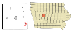
Location of Rippey, Iowa
|
|
| Country | |
| State | |
| County | Greene |
| Area | |
| • Total | 0.87 sq mi (2.24 km2) |
| • Land | 0.87 sq mi (2.24 km2) |
| • Water | 0.00 sq mi (0.00 km2) |
| Elevation | 1,073 ft (327 m) |
| Population
(2020)
|
|
| • Total | 220 |
| • Density | 254.04/sq mi (98.12/km2) |
| Time zone | UTC-6 (Central (CST)) |
| • Summer (DST) | UTC-5 (CDT) |
| ZIP code |
50235
|
| Area code(s) | 515 |
| FIPS code | 19-67215 |
| GNIS feature ID | 2396379 |
Rippey is a small city located in Greene County, Iowa, in the United States. In 2020, about 220 people lived there. Rippey is known for its friendly community and its annual winter bike ride event.
Contents
Where is Rippey Located?
Rippey is found in Greene County, Iowa. The city covers a total area of about 0.84 square miles (2.2 square kilometers). All of this area is land, meaning there are no large lakes or rivers within the city limits.
What is Rippey's History?
Rippey started as a town in 1870. This happened when the Des Moines Valley Railroad was built through the area. The railroad helped the town grow and connect with other places.
Coal Mining in Rippey
In the late 1800s, Rippey and a nearby town called Angus were important centers for coal mining. Many coal mines opened in this region. Companies like Keystone Coal Company and Snake Creek Coal Company operated mines near Rippey. One mine was even very close to the Rippey railroad station. These mines helped the local economy for many years.
How Many People Live in Rippey?
Rippey is a small community. The number of people living in Rippey has changed over the years.
| Historical populations | ||
|---|---|---|
| Year | Pop. | ±% |
| 1900 | 395 | — |
| 1910 | 407 | +3.0% |
| 1920 | 409 | +0.5% |
| 1930 | 357 | −12.7% |
| 1940 | 421 | +17.9% |
| 1950 | 354 | −15.9% |
| 1960 | 331 | −6.5% |
| 1970 | 270 | −18.4% |
| 1980 | 304 | +12.6% |
| 1990 | 275 | −9.5% |
| 2000 | 319 | +16.0% |
| 2010 | 292 | −8.5% |
| 2020 | 220 | −24.7% |
| Source: and Iowa Data Center Source: |
||
Rippey's Population in 2020
According to the 2020 census, 220 people lived in Rippey. There were 103 households and 61 families. Most residents were White. About 7.3% of the population identified as Hispanic or Latino. The average age in Rippey was about 43.5 years old.
What About Education in Rippey?
Today, students in Rippey attend schools in the Greene County Community School District. This district operates Greene County Elementary, Middle, and High schools in Jefferson.
Rippey's Old Schools
A long time ago, in the late 1800s, Rippey had its own high school. There were also many small grade schools in the countryside nearby. In 1919, people voted to build a new school called Rippey Consolidated School. This school opened in 1921 and replaced all the older schools. A gym, called Wisecup Memorial Gymnasium, was added in 1957.
In 1963, Rippey joined the East Greene Community School District. The Rippey School became the elementary school for this district. Older students went to school in Grand Junction.
Changes to Rippey School
The Rippey School closed its doors on May 18, 2012. Elementary students then moved to Grand Junction. Middle and high school students started attending schools in the Jefferson–Scranton Community School District. The Rippey School building was later taken down in October 2014. A monument and a park were built where the school once stood. The gymnasium is still there.
Does Rippey Have a Windfarm?
Yes, there is a large windfarm located near Rippey. It was built in 2012 and can produce 50 megawatts of power. This windfarm has 20 tall wind turbines, each about 100 meters (328 feet) high. These turbines help create clean energy for the area. The power from the windfarm is bought by Central Iowa Power Cooperative.
What is the Bicycle Ride to Rippey (BRR)?
One of the most exciting events near Rippey is the Bicycle Ride to Rippey, or BRR. This fun bike ride happens every year on the first Saturday in February. It started in 1978 with just 22 riders. Now, thousands of bicyclists participate!
The BRR Experience
The BRR ride starts and ends in Perry. It's a 24-mile (38.6 km) ride that is often very cold and sometimes even frozen! Many people see it as the start of the RAGBRAI season, which is a famous bike ride across Iowa. Riders gather in Perry for breakfast and then depart for Rippey. The town of Rippey gives a warm welcome to all the riders, making it a highlight of the event.
See also
 In Spanish: Rippey (Iowa) para niños
 | Precious Adams |
 | Lauren Anderson |
 | Janet Collins |

