Perry, Iowa facts for kids
Quick facts for kids
Perry, Iowa
|
|
|---|---|
 |
|
| Motto(s):
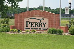
Make yourself at home!
|
|

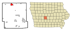
Location of Perry, Iowa
|
|
| Country | |
| State | |
| County | Dallas |
| Area | |
| • Total | 5.49 sq mi (14.22 km2) |
| • Land | 5.49 sq mi (14.21 km2) |
| • Water | 0.01 sq mi (0.01 km2) |
| Elevation | 954 ft (291 m) |
| Population
(2020)
|
|
| • Total | 7,836 |
| • Density | 1,428.36/sq mi (551.47/km2) |
| Time zone | UTC-6 (Central (CST)) |
| • Summer (DST) | UTC-5 (CDT) |
| ZIP code |
50220
|
| Area code(s) | 515 |
| FIPS code | 19-62355 |
| GNIS feature ID | 2396183 |
Perry is a city located in Dallas County, Iowa, in the United States. It sits right next to the North Raccoon River. In 2020, about 7,836 people lived there. Perry is also part of the larger Des Moines area.
Contents
- Discovering Perry's Past: A Look at Its History
- Exploring Perry's Location and Landscape
- Understanding Perry's Weather and Climate
- Who Lives in Perry? Understanding Demographics
- Perry's Economy: Jobs and Industries
- Learning in Perry: Schools and Education
- Media in Perry: Local News and Radio
- Famous Faces from Perry: Notable People
- See also
Discovering Perry's Past: A Look at Its History
Perry was first planned as a town in 1869. The original town area had specific boundaries. These were Estella Street to the south and Dewey Avenue to the north. On the east, it was 8th Street, and on the west, it was 3rd Street.
Exploring Perry's Location and Landscape
Perry is located at 41°50′24″N 94°6′0″W / 41.84000°N 94.10000°W.
The city covers a total area of about 4.18 square miles. Most of this area is land, about 4.17 square miles. Only a small part, 0.01 square miles, is water.
Understanding Perry's Weather and Climate
Perry experiences a type of weather called a hot-summer humid continental climate. This means it has warm, humid summers and cold winters. On climate maps, this is often shown as "Dfa."
| Climate data for Perry, Iowa, 1991–2020 normals, extremes 1900–present | |||||||||||||
|---|---|---|---|---|---|---|---|---|---|---|---|---|---|
| Month | Jan | Feb | Mar | Apr | May | Jun | Jul | Aug | Sep | Oct | Nov | Dec | Year |
| Record high °F (°C) | 67 (19) |
76 (24) |
89 (32) |
95 (35) |
105 (41) |
105 (41) |
110 (43) |
111 (44) |
104 (40) |
95 (35) |
83 (28) |
73 (23) |
111 (44) |
| Mean maximum °F (°C) | 51.7 (10.9) |
56.9 (13.8) |
72.4 (22.4) |
83.3 (28.5) |
89.2 (31.8) |
93.1 (33.9) |
95.0 (35.0) |
93.8 (34.3) |
90.7 (32.6) |
84.3 (29.1) |
69.9 (21.1) |
56.1 (13.4) |
96.9 (36.1) |
| Mean daily maximum °F (°C) | 29.5 (−1.4) |
34.0 (1.1) |
47.5 (8.6) |
61.3 (16.3) |
71.9 (22.2) |
81.9 (27.7) |
85.4 (29.7) |
83.3 (28.5) |
77.1 (25.1) |
64.0 (17.8) |
47.8 (8.8) |
35.0 (1.7) |
59.9 (15.5) |
| Daily mean °F (°C) | 19.8 (−6.8) |
24.1 (−4.4) |
36.6 (2.6) |
49.0 (9.4) |
60.5 (15.8) |
70.9 (21.6) |
74.5 (23.6) |
72.1 (22.3) |
64.3 (17.9) |
51.5 (10.8) |
37.3 (2.9) |
25.7 (−3.5) |
48.9 (9.4) |
| Mean daily minimum °F (°C) | 10.2 (−12.1) |
14.1 (−9.9) |
25.8 (−3.4) |
36.7 (2.6) |
49.0 (9.4) |
59.8 (15.4) |
63.5 (17.5) |
60.8 (16.0) |
51.5 (10.8) |
39.1 (3.9) |
26.8 (−2.9) |
16.5 (−8.6) |
37.8 (3.2) |
| Mean minimum °F (°C) | −11.8 (−24.3) |
−7.0 (−21.7) |
5.7 (−14.6) |
21.8 (−5.7) |
34.9 (1.6) |
47.3 (8.5) |
52.9 (11.6) |
50.9 (10.5) |
36.0 (2.2) |
23.8 (−4.6) |
10.2 (−12.1) |
−3.6 (−19.8) |
−15.6 (−26.4) |
| Record low °F (°C) | −32 (−36) |
−33 (−36) |
−30 (−34) |
6 (−14) |
20 (−7) |
34 (1) |
42 (6) |
34 (1) |
22 (−6) |
−8 (−22) |
−13 (−25) |
−34 (−37) |
−34 (−37) |
| Average precipitation inches (mm) | 0.95 (24) |
1.14 (29) |
1.96 (50) |
4.10 (104) |
5.15 (131) |
4.88 (124) |
4.42 (112) |
4.14 (105) |
3.44 (87) |
2.70 (69) |
1.86 (47) |
1.38 (35) |
36.12 (917) |
| Average snowfall inches (cm) | 4.6 (12) |
5.1 (13) |
3.8 (9.7) |
0.9 (2.3) |
0.0 (0.0) |
0.0 (0.0) |
0.0 (0.0) |
0.0 (0.0) |
0.0 (0.0) |
0.1 (0.25) |
1.8 (4.6) |
7.2 (18) |
23.5 (59.85) |
| Average precipitation days (≥ 0.01 in) | 7.1 | 7.5 | 8.5 | 11.7 | 13.7 | 12.3 | 9.6 | 10.3 | 9.0 | 9.3 | 7.1 | 8.0 | 114.1 |
| Average snowy days (≥ 0.1 in) | 3.1 | 2.9 | 1.5 | 0.3 | 0.0 | 0.0 | 0.0 | 0.0 | 0.0 | 0.0 | 0.9 | 3.7 | 12.4 |
| Source 1: NOAA (average snowfall, snow days 1981–2010) | |||||||||||||
| Source 2: National Weather Service | |||||||||||||
Who Lives in Perry? Understanding Demographics
The population of Perry has changed over many years. You can see how it grew in the table below.
| Historical populations | ||
|---|---|---|
| Year | Pop. | ±% |
| 1880 | 952 | — |
| 1890 | 2,880 | +202.5% |
| 1900 | 3,986 | +38.4% |
| 1910 | 4,630 | +16.2% |
| 1920 | 5,642 | +21.9% |
| 1930 | 5,881 | +4.2% |
| 1940 | 5,977 | +1.6% |
| 1950 | 6,174 | +3.3% |
| 1960 | 6,442 | +4.3% |
| 1970 | 6,906 | +7.2% |
| 1980 | 7,053 | +2.1% |
| 1990 | 6,652 | −5.7% |
| 2000 | 7,633 | +14.7% |
| 2010 | 7,702 | +0.9% |
| 2020 | 7,836 | +1.7% |
| Source: and Iowa Data Center Source: U.S. Decennial Census |
||
2020 Census: A Snapshot of Perry's Population
In 2020, the census showed that 7,836 people lived in Perry. The city has a diverse population. About 55% of residents were White. Around 37% of the population identified as Hispanic or Latino. Other groups like Black or African American, Asian, and people of mixed races also live in Perry.
| Race / Ethnicity (NH = Non-Hispanic) | Pop 2000 | Pop 2010 | Pop 2020 | % 2000 | % 2010 | % 2020 |
|---|---|---|---|---|---|---|
| White alone (NH) | 5,561 | 4,709 | 4,348 | 72.85% | 61.14% | 55.49% |
| Black or African American alone (NH) | 65 | 120 | 258 | 0.85% | 1.56% | 3.29% |
| Native American or Alaska Native alone (NH) | 14 | 18 | 11 | 0.18% | 0.23% | 0.14% |
| Asian alone (NH) | 55 | 60 | 84 | 0.72% | 0.78% | 1.07% |
| Pacific Islander alone (NH) | 2 | 10 | 4 | 0.03% | 0.13% | 0.05% |
| Other race alone (NH) | 12 | 12 | 21 | 0.16% | 0.16% | 0.27% |
| Mixed race or Multiracial (NH) | 51 | 81 | 208 | 0.67% | 1.05% | 2.65% |
| Hispanic or Latino (any race) | 1,873 | 2,692 | 2,902 | 24.54% | 34.95% | 37.03% |
| Total | 7,633 | 7,702 | 7,836 | 100.00% | 100.00% | 100.00% |
2010 Census: A Look at Perry's Community
In 2010, Perry had 7,702 people living in 2,792 households. About 38% of these households had children under 18. Many households were married couples living together.
The average age of people in Perry was 33.3 years. Almost 30% of residents were under 18. The number of males and females was almost equal.
Perry's Economy: Jobs and Industries
For a long time, the main employer in Perry was the Tyson Foods pork plant. However, in March 2024, Tyson Foods announced that the plant would close. This decision meant about 1,300 jobs would be lost. Around 800 employees who lived in Perry were affected by this closure.
Learning in Perry: Schools and Education
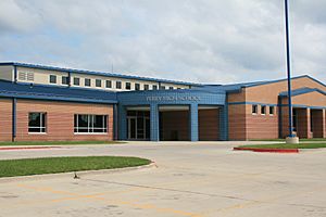
The Perry Community School District runs the public schools in the area.
There is also a Catholic school in Perry called St. Patrick School. It was opened in 1921. For Catholic high school students, the nearest option is Dowling Catholic High School in West Des Moines.
Media in Perry: Local News and Radio
Perry has its own local media. This includes radio stations that serve the community.
- KDLS-FM
- KDLS (AM)
- KICG
Famous Faces from Perry: Notable People
Many interesting people have connections to Perry.
- William Bell (1902–1971) was a very talented American tuba player and teacher.
- Sam Brinton (born around 1988) is a nuclear engineer and an activist for LGBTQ+ rights.
- George W. Clarke (1906–2006) was a politician in Washington State.
- Gertrude Mary Cox (1900–1978) was an important American statistician.
- Dan Grimm (1941–2018) was an American football player who played in the NFL.
- V. T. Hamlin (1900–1993) was a cartoonist who created the famous comic strip Alley Oop.
- Dwight D. Opperman (1923–2013) was the CEO of West Publishing, which later became Thomson Reuters.
- Jessica Reznicek (born 1981) is an activist known for her work with the Catholic Worker Movement and environmental causes.
See also
 In Spanish: Perry (Iowa) para niños
 | Kyle Baker |
 | Joseph Yoakum |
 | Laura Wheeler Waring |
 | Henry Ossawa Tanner |


