River Box facts for kids
The River Box is a small river, about 23 kilometers (14 miles) long, that flows through Suffolk, England. It is a smaller river that joins the larger River Stour.
Quick facts for kids River Box |
|
|---|---|

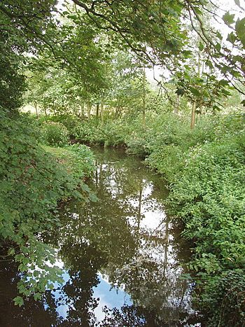
River Box near Scotland Street
|
|
| Country | England |
| Counties | Suffolk |
| Villages | Boxford |
| Physical characteristics | |
| Main source | Humble Green, Suffolk 52°05′01″N 0°48′41″E / 52.0836°N 0.8114°E |
| River mouth | Higham, Suffolk 51°58′30″N 0°57′11″E / 51.975°N 0.953°E |
| Length | 23 km (14 mi) |
| Basin features | |
| Basin size | 67 km2 (26 sq mi) |
| Progression : River Box—Stour—North Sea | |
Contents
What's in a Name? The River Box Story
The name "River Box" actually comes from the village of Boxford. It's like the village gave its name to the river!
Long ago, in an old English text from after the year 991, the river had a different name: Amalburna. Experts think this old name might have come from a very old British word, ambro, which means "water".
The River's Journey
The River Box starts its journey north of Little Waldingfield. It begins as a small stream, and soon two other tiny streams join it at a place called Upsher Green.
From there, the river flows mostly southeast. It passes by Edwardstone and then reaches the bigger village of Boxford. In Boxford, the A1071 crosses over the river.
The river keeps flowing in the same direction, passing through several small villages and hamlets. Many of these places have "Street" in their name, like Stone Street and Mill Street (near Polstead). It also goes past Scotland Street and Thorington Street, near Thorington Hall.
Finally, the River Box continues southeast until it meets the River Stour. This meeting point is between Langham and Higham, and it's also close to where another river, the River Brett, joins the Stour.
How We Measure the River
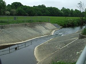
Since 1960, people have been measuring how much water flows in the River Box. They do this in the middle part of the river, near Polstead, using a special device called a flume.
This flume helps them understand the river's flow. The area of land that drains water into the river upstream of this measuring point is about 54 square kilometers (21 square miles). On average, about 0.22 cubic meters (7.8 cubic feet) of water flow past this point every second.
The highest water level ever recorded at the flume was in January 1998. The water was 1.25 meters (4.1 feet) high, and it was estimated that about 10 cubic meters (350 cubic feet) of water were flowing per second!
The land around the river, upstream from the measuring station, gets about 566 millimeters (22.3 inches) of rain each year. The highest point in this area is about 83.6 meters (274 feet) above sea level. Most of the land here is used for farming.
River Health
The River Box has been checked for its ecological quality, which means how healthy its environment is for plants and animals. It has been given a "moderate" rating under something called the Water Framework Directive.
This "moderate" rating is in the middle of a five-step scale. The best rating is "high," then "good," "moderate," "poor," and finally "bad." So, the River Box is doing okay, but there's always room for it to become even healthier!
 | Stephanie Wilson |
 | Charles Bolden |
 | Ronald McNair |
 | Frederick D. Gregory |


