River Colne, Essex facts for kids
Quick facts for kids Colne |
|
|---|---|

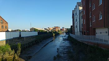
The River Colne near Colchester, looking south
|
|
| Country | England |
| Region | Essex |
| City | Colchester |
| Physical characteristics | |
| Main source | near Cornish Hall End 104 m (341 ft) 52°00′52″N 0°26′19″E / 52.0144°N 0.4387°E |
| River mouth | North Sea Brightlingsea 0 m (0 ft) 51°48′03″N 1°00′37″E / 51.8007°N 1.0102°E |
| Length | 62 km (39 mi) |
The River Colne is a small river in Essex, England. It flows through the historic town of Colchester. Unlike many rivers, the Colne does not join another river. Instead, it flows directly into the sea through an estuary near Brightlingsea. An estuary is where a river meets the sea, mixing fresh and salt water.
The River Colne in Colchester
As the River Colne reaches Colchester, it flows through a wide, flat area. This area is called a floodplain. It is about 300 meters (984 feet) wide. Farmers use this land for pasture, which means animals like cows can graze there. The river can sometimes rise and flood these fields.
Near Colchester North railway station, the river goes under a bridge. It then enters a special concrete area. This spot was once a swimming area until the 1970s. Today, it is a popular place for canoeists.
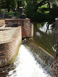
The river then winds its way under a road bridge at North Hill. It flows over a weir at Middlemill. A weir is like a small dam that controls the water flow. There used to be a mill here, but it is gone now. The river forms a border for Colchester's Castle Park and the local cricket ground. Footbridges cross the river, connecting the town center to homes on the other side. Sometimes, the floodplain here can also get wet if the river rises too much. The river also goes around a small lake. After this, it turns south and becomes a tidal river. This means its water level changes with the ocean tides.
The River Colne After Colchester
Once the River Colne leaves Colchester, you can see large areas of mud when the tide is low. It flows through an area called the Hythe. It then passes by the University of Essex campus. The river continues through the village of Rowhedge and the town of Wivenhoe. It goes past a special barrier that helps control the tides. Finally, it reaches Brightlingsea and joins the North Sea. From the barrier onwards, special buoys mark the path for boats.
Exploring the River Colne's Banks
Along the banks of the River Colne, you might spot old concrete structures. These are pillboxes from the Second World War. They were built to defend the area during the war. You can often find them near bridges or other places where people could cross the river.
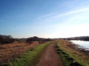
The National Cycle Network Route 51 follows the Colne. This path goes from Castle Park in Colchester to Wivenhoe Railway Station. It is a mix of paved paths and dirt trails. It is a great way to explore the river's surroundings. The path passes the Hythe and the university.
The Hythe area in Colchester was once a busy port. From Roman times, ships used the Colne to bring goods to the town. However, the river is not deep enough for large ships anymore. Because of this, water trade has stopped here. Plans in the Victorian era to make the river deeper did not work out.
 | May Edward Chinn |
 | Rebecca Cole |
 | Alexa Canady |
 | Dorothy Lavinia Brown |


