River Eye, Gloucestershire facts for kids
Quick facts for kids Eye |
|
|---|---|

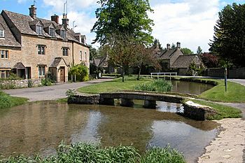
River Eye at Lower Slaughter
|
|
|
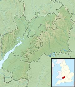
Location within Gloucestershire
|
|
| Country | England |
| Region | Gloucestershire |
| Physical characteristics | |
| Main source | Eyford Park 51°55′44″N 1°47′06″W / 51.929°N 1.785°W 160 m (520 ft) |
| River mouth | River Dikler near Bourton-on-the-Water 130 m (430 ft) 51°53′10″N 1°44′20″W / 51.886°N 1.739°W |
| Length | 7.6 km (4.7 mi) |
| Basin features | |
| River system | River Dikler (River Windrush) |
The River Eye is a small river in the Cotswold District of Gloucestershire, England. It flows for about 7.6 kilometers (4.7 miles). This lovely river passes through the charming villages of Upper Slaughter and Lower Slaughter. You can find brown trout living in its waters.
Contents
Where the River Eye Flows
Where the River Eye Starts
The River Eye begins its journey in a spring. This spring is located in the beautiful Cotswold Hills. It starts at about 160 meters (525 feet) high. The river flows south through a valley. This valley has steep sides.
The river runs through the land of Eyford Park. This park has a large house built in the early 1900s. It also has famous gardens. Here, the river has two dams. These dams create two lakes for the house. They are called "Upper Lake" and "The Lake."
Journey Through Villages
After Eyford Park, the river crosses a road called the B4068. It then joins a walking path known as "Warden's Way." This path goes from Bourton-on-the-Water to Winchcombe. After about one kilometer, the river passes St Peter's Church. This is the church for the small village of Upper Slaughter. The river flows around the north and east sides of the village.
The river then turns southeast. It flows downhill into Lower Slaughter. After another kilometer, it passes under an old water mill. A mill was first recorded here in the Domesday Book. This book was a big survey from 1086. The mill made flour for the village until 1958. Now, it is a shop and a museum. You can see the old mill machinery inside.
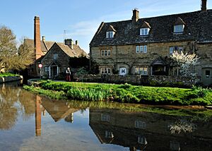
The River Eye runs right through the middle of Lower Slaughter. This village is very popular with tourists. The river is often called Slaughter Brook here. It creates a beautiful scene with the old Cotswold stone cottages.
The River's End
After leaving Lower Slaughter, the river flows under the Roman Fosse Way. This is an ancient Roman road. The river then forms the border between Lower Slaughter and Bourton-on-the-Water. It winds through fields where sheep graze.
The River Eye flows next to the River Dikler for about one kilometer. Finally, it empties into the River Dikler. This happens about one kilometer east of Bourton-on-the-Water. The River Dikler then flows into the River Windrush just two kilometers later.
River Eye History
The name of Eyford Park comes from the river. "Eyford" means there was once a place where people could cross the river. This crossing point was called a ford.
 | Madam C. J. Walker |
 | Janet Emerson Bashen |
 | Annie Turnbo Malone |
 | Maggie L. Walker |


