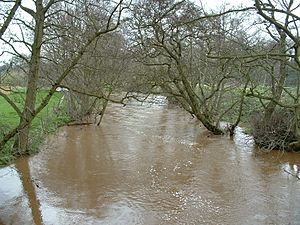
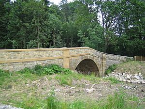
River Rye, Yorkshire facts for kids
Quick facts for kids River Rye |
|
|---|---|
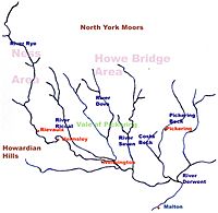
The catchment area of the River Rye
|
|
| Physical characteristics | |
| Main source | Cleveland Hills 660 ft (200 m) |
| River mouth | Howe Bridge |
| Basin features | |
| River system | River Derwent, Yorkshire |
| Basin size | 330 sq mi (850 km2) |
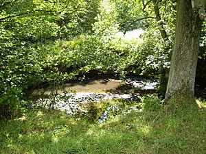
The River Rye is a river in North Yorkshire, England. It starts in the Cleveland Hills and flows through many towns and villages. These include Hawnby, Helmsley, and Nunnington. Eventually, it joins another river called the River Derwent near Malton.
The area around the river is called a dale, which is a type of valley. This valley gave its name to the Ryedale district. This district stretches southwest towards the River Derwent.
Contents
Where Does the River Rye Flow?
The River Rye begins at a place called Rye Head on Snilesworth Moor. This is in the Cleveland Hills. As it flows, it collects water from other smaller rivers. One of these is the River Seph, which flows through Bilsdale.
The river then passes by the famous Rievaulx Abbey. After this, it enters a flat area known as the Vale of Pickering near Helmsley.
Tributaries Joining the River Rye
As the River Rye moves east from Helmsley, it gets more water from other rivers. The River Dove flows into it from Farndale. The River Dove has already collected water from Hodge Beck, which comes from Bransdale.
Interestingly, Hodge Beck sometimes disappears underground! It flows through limestone in Kirkdale and then reappears further down the valley. The town of Kirkbymoorside is also on the River Dove.
Another river, the River Seven, flows from Rosedale and joins the Rye near Sinnington. Finally, Pickering Beck, which comes from the steep Newtondale, joins the Costa Beck. The Costa Beck then flows into the River Rye just before the Rye meets the River Derwent.
How the River Rye is Managed
For easier management, the River Rye is split into two main sections. These are called Ness and Howe Bridge.
Ness: The Upper River Rye
The Ness area is the upstream part of the river. It covers about 59,000 acres (239 square kilometers). This section includes the River Rye and all its smaller rivers from where it starts, all the way to where it meets the River Dove near East Ness.
This area is mostly countryside with small villages spread out. The northern part has high moors, over 660 feet (200 meters) tall, which are part of the North York Moors National Park. Here, the land is mostly used for grazing animals.
Further downstream, near Rievaulx and Helmsley, the land is lower, around 330 feet (100 meters). It drops to about 160 feet (50 meters) at East Ness. In this lower part, farmers grow crops and raise animals. There are also forests and woodlands near the river.
Water is taken from the river mainly to supply a fish farm at Harome. This water is then returned to the river. There are also water treatment plants in Helmsley and Sproxton. The health of the river's plants, animals, and fish is very sensitive to how much water is flowing.
Howe Bridge: The Lower River Rye
The Howe Bridge area is the downstream part of the River Rye. It covers a much larger area, about 152,000 acres (615 square kilometers). This section goes from East Ness to where the River Rye joins the River Derwent near Howe Bridge.
In this area, the main rivers that join the Rye are the River Riccal, the River Dove (with Hodge Beck), the River Seven, Costa Beck, and Pickering Beck.
The biggest towns in this area are Pickering and Kirkbymoorside. The rest of the area is mostly rural with different types of landscapes. To the north are the high moors of the North York Moors. These moors have valleys like Bransdale, Farndale, Rosedale, and Newtondale. Much of the moorland is over 980 feet (300 meters) high, with the highest point being 1,410 feet (430 meters).
To the south, the rivers from these valleys come together, and the land becomes flatter. It is mostly lower than 330 feet (100 meters). To the southwest, the Howe Bridge area includes the rolling hills of the Howardian Hills.
The largest amounts of water are taken from the river here for fish farming. There are also water treatment plants in Pickering, Harome, and Kirkbymoorside.
Geology of the River Rye Area
Where the River Rye and its smaller rivers begin, they flow over a type of rock called Corallian limestone. This rock can be seen on the hills around the Vale of Pickering. In some places, the river water sinks into holes in the riverbed. This happens at Kirkdale and Kirkby Mills.
Underneath the River Rye and its tributaries in the Vale of Pickering, there are deposits left by a large lake from the last ice age. Newtondale was a channel where meltwater flowed from the North York Moors when the ice age ended. This is why its valley is much deeper than what the current Pickering Beck would suggest.
History of the River Rye
For hundreds of years, the fast-flowing streams of the River Rye and its tributaries powered water mills. These mills were used for grinding grain or other tasks. There were three mills in Pickering and others at Kirkby Mills, near Kirkbymoorside. A mill in Bransdale is owned by the National Trust, but visitors cannot go inside.
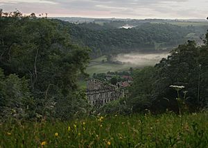
Rievaulx Abbey was built next to the River Rye. The monks who lived there even changed the river's path to move it away from their buildings! The abbey's name comes from a French phrase meaning "Rye Valley."
Near the Costa Beck, south of Pickering, scientists found signs of a very old settlement from prehistoric times. They dug up these traces in the late 1800s.
What is the River Rye Used For?
The River Rye is very important for the local economy. It provides water for farms, for homes, and for fish farms. People also use the river for fun activities like fishing. It also helps to carry away water that has been treated by wastewater plants.
Protecting Nature Along the River Rye
Many areas around the River Rye are specially protected to help nature.
The North York Moors are a Special Protection Area. This means they are protected to help birds, their nests, and their homes. They are also a Special Area of Conservation. This helps to protect many different types of plants and animals, not just birds.
There are also several Sites of Special Scientific Interest (SSSIs) in the area. These are places that are important for their plants, animals, or geology. Some of these include Farndale, Newton Dale, and Duncombe Park.
Duncombe Park is a National Nature Reserve (NNR), which means it's a very important place for wildlife. The Howardian Hills are also a special area, recognized as an Area of Outstanding Natural Beauty.
 | Charles R. Drew |
 | Benjamin Banneker |
 | Jane C. Wright |
 | Roger Arliner Young |


